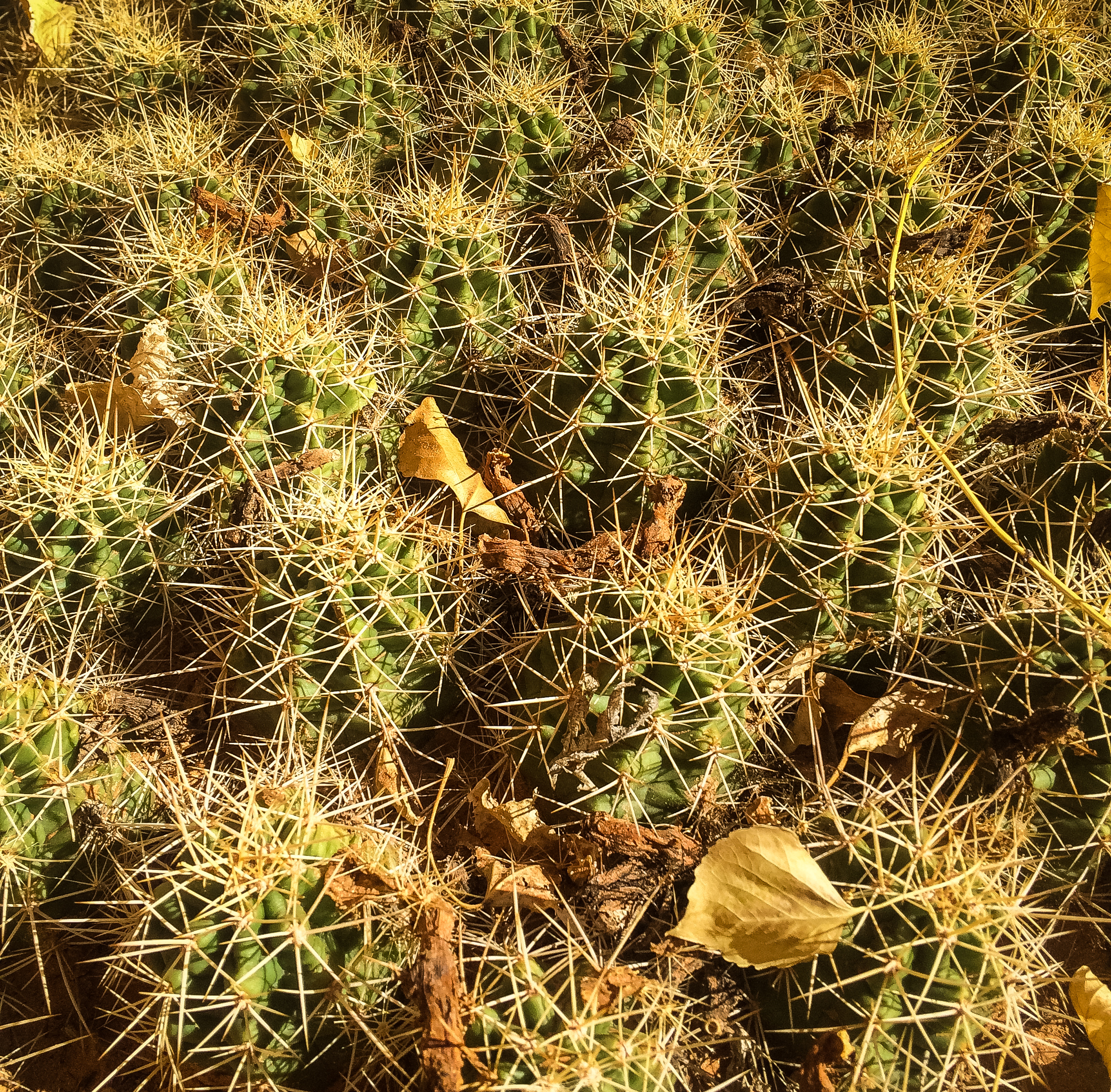
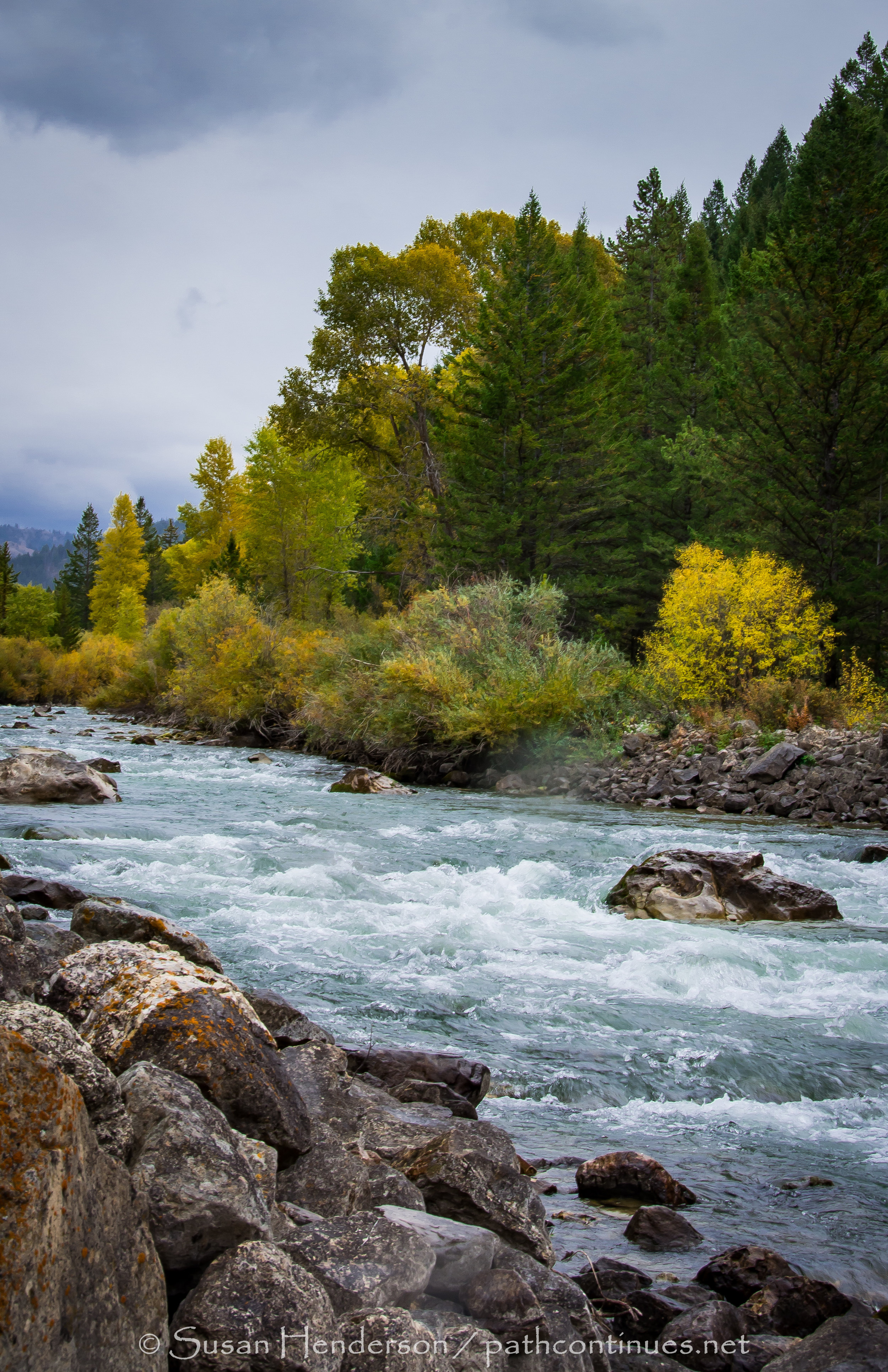
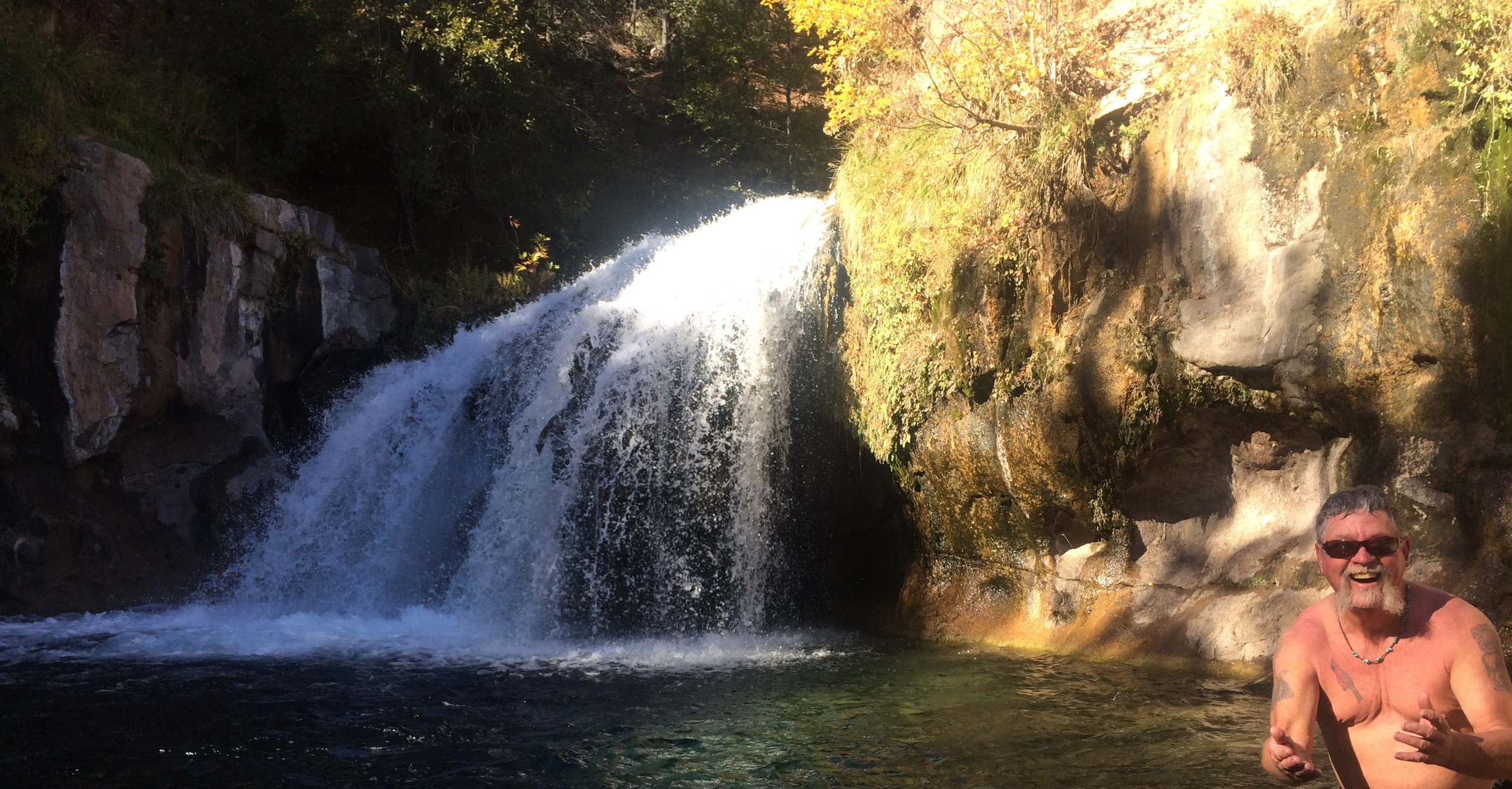
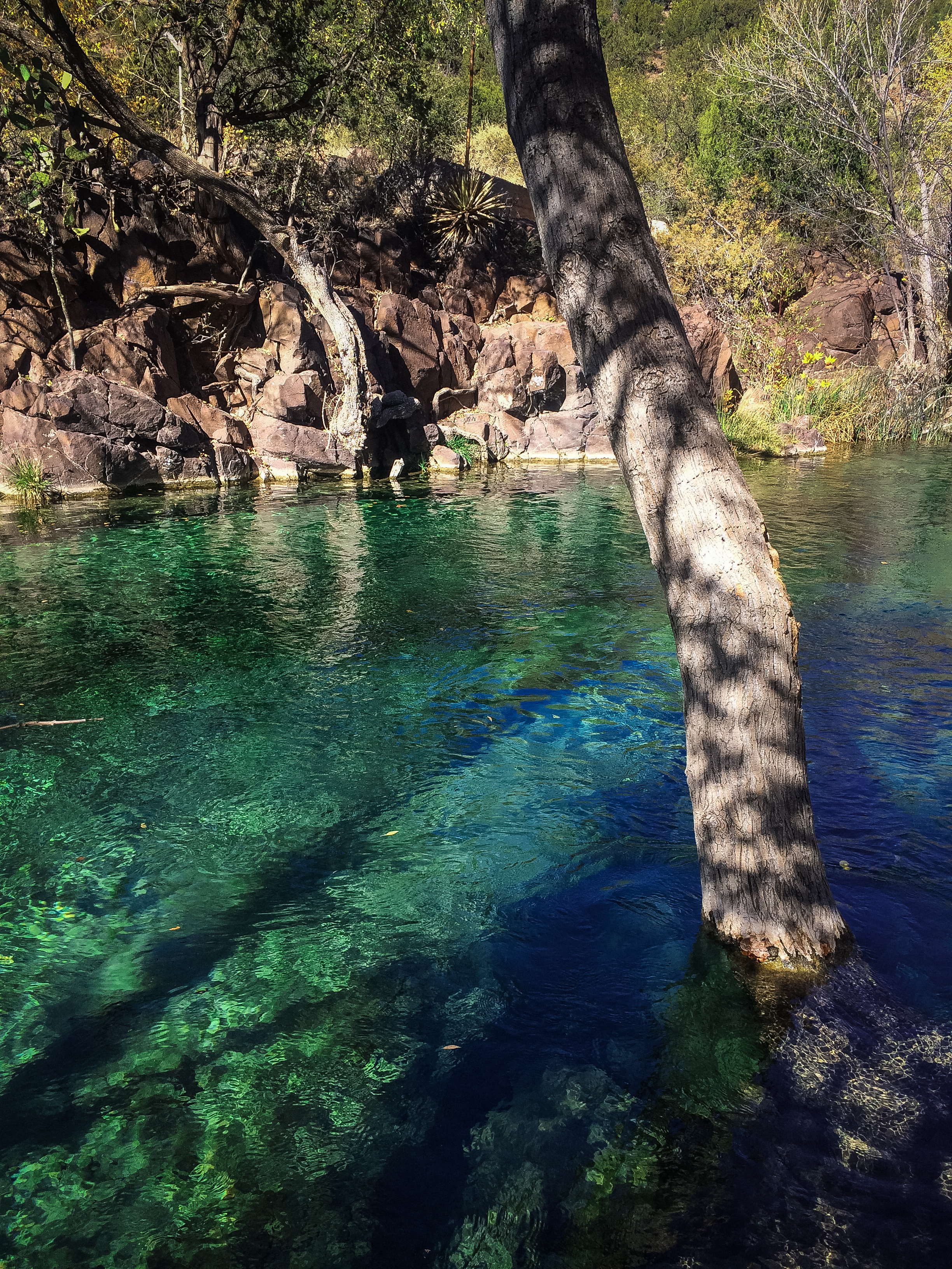
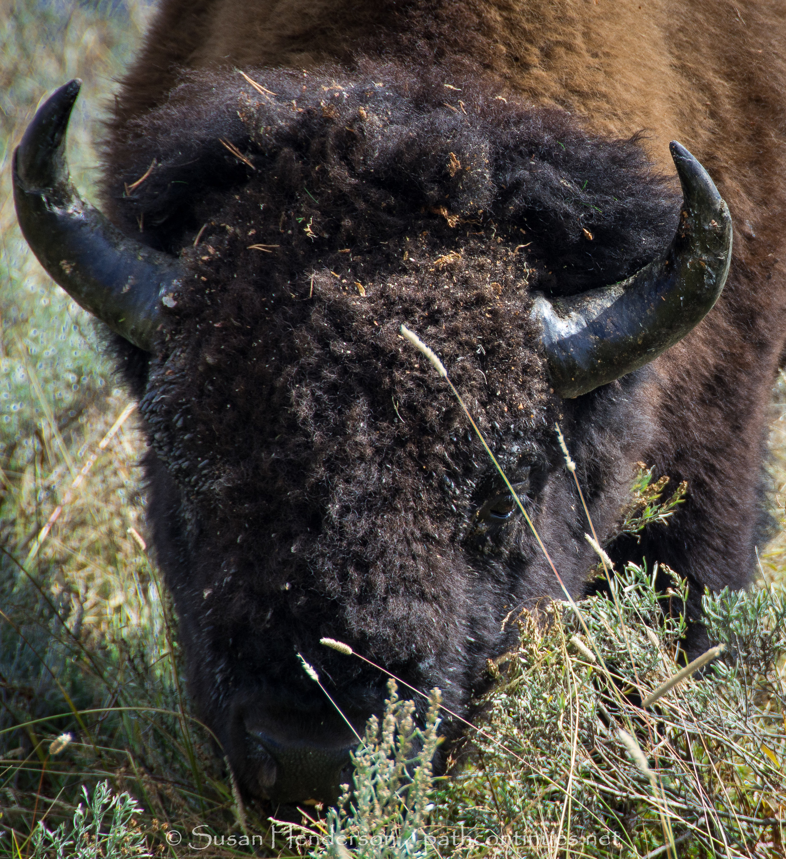
Thankful for the beauty of nature
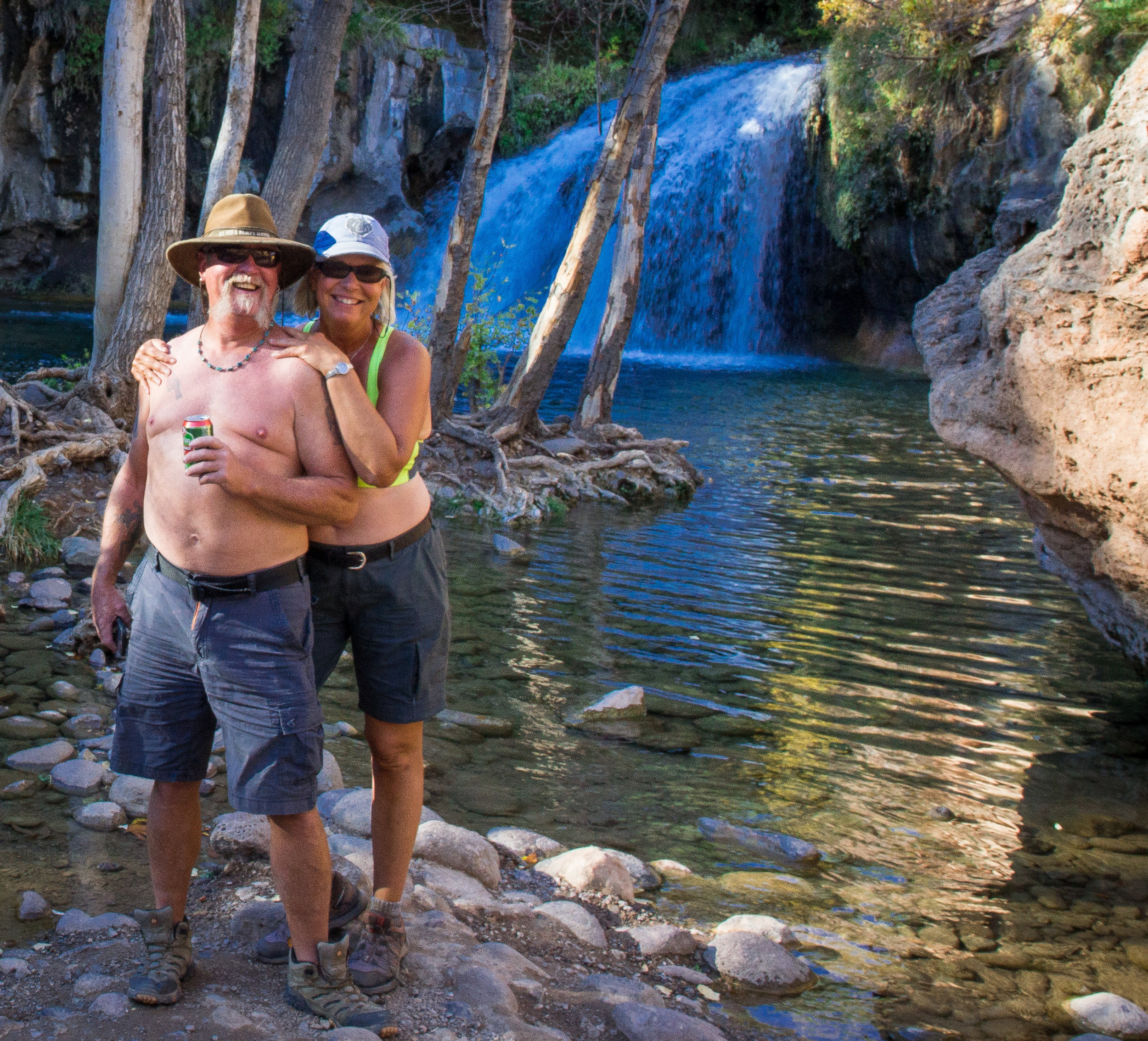
Thankful for our family
Thankful for our health
Thankful for the life we lead
Thankful for this very special Thanksgving Day

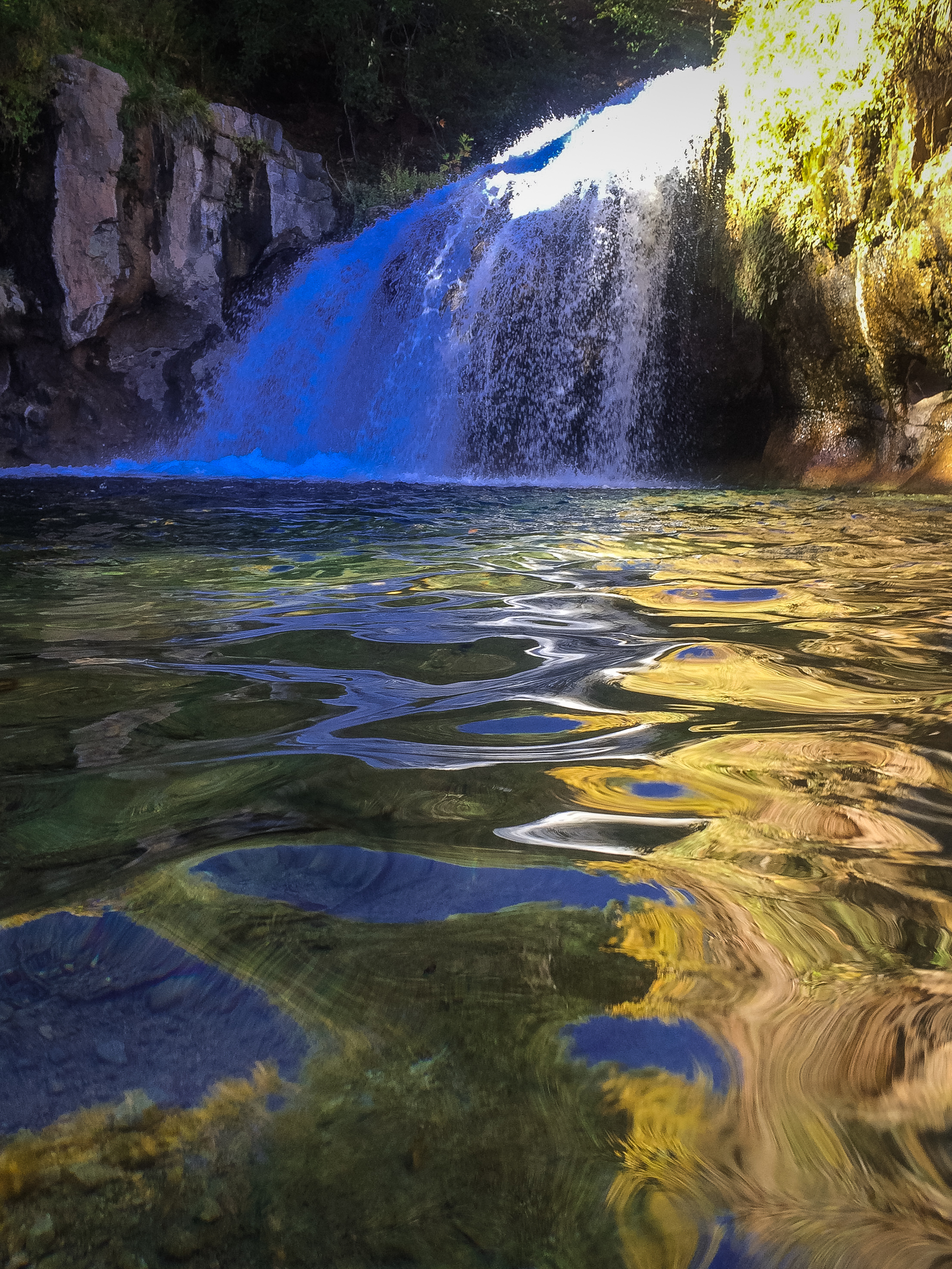
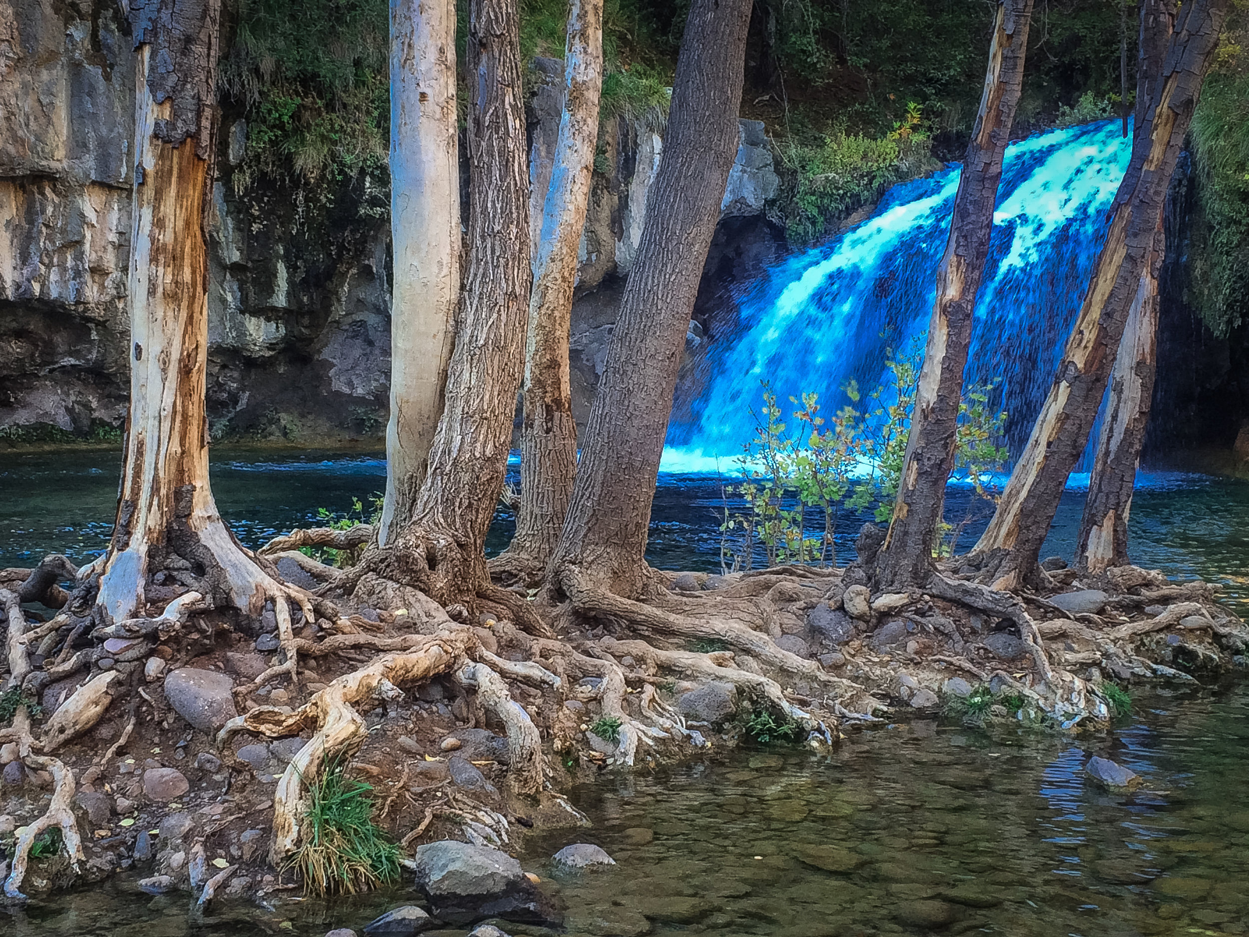
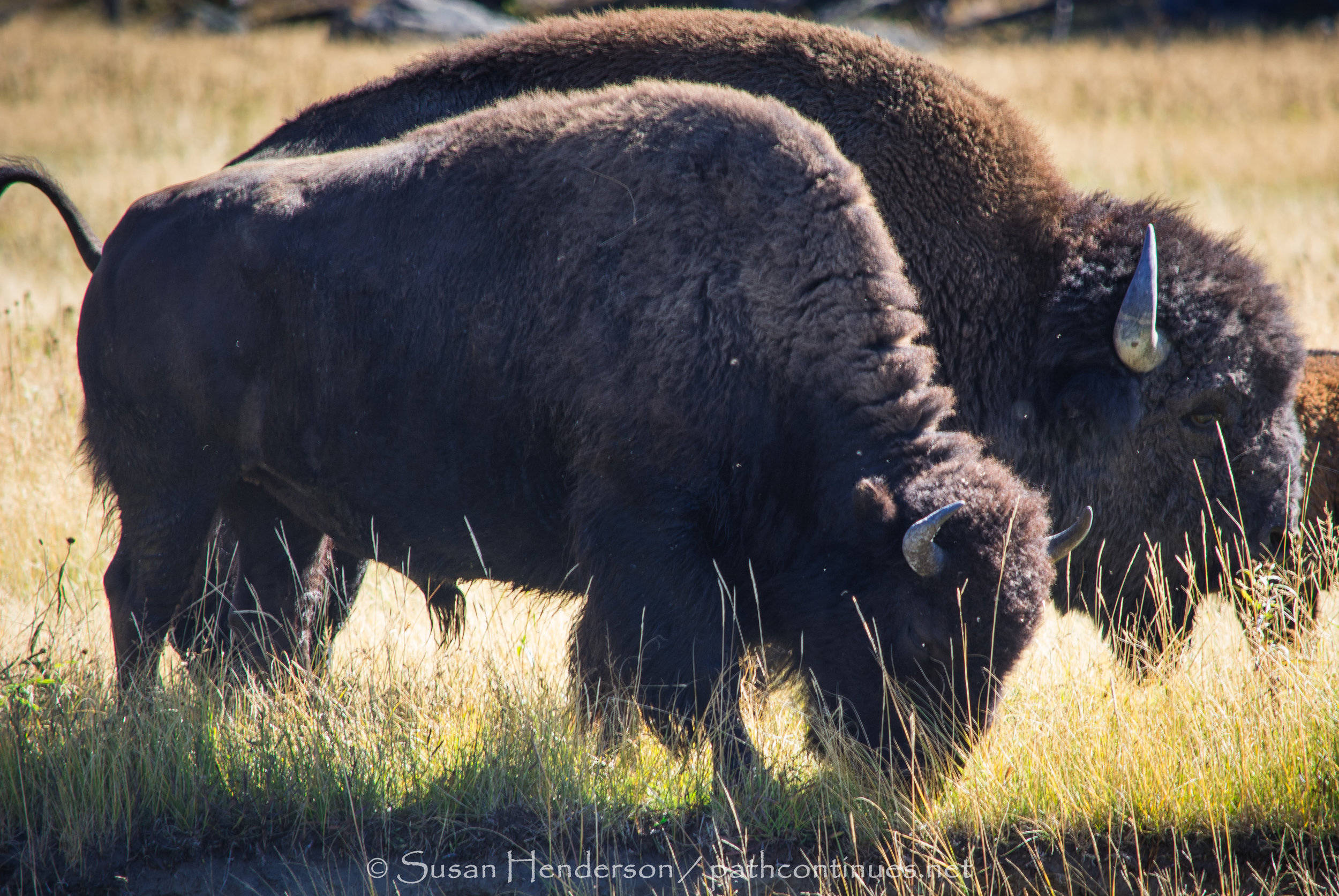
Thankful for the beauty of nature
Thankful for our family
Thankful for our health
Thankful for the life we lead
Thankful for this very special Thanksgving Day
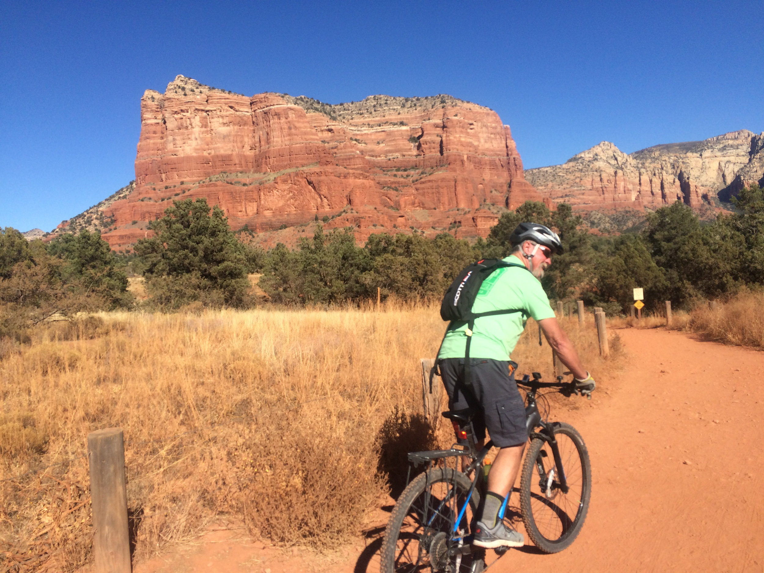
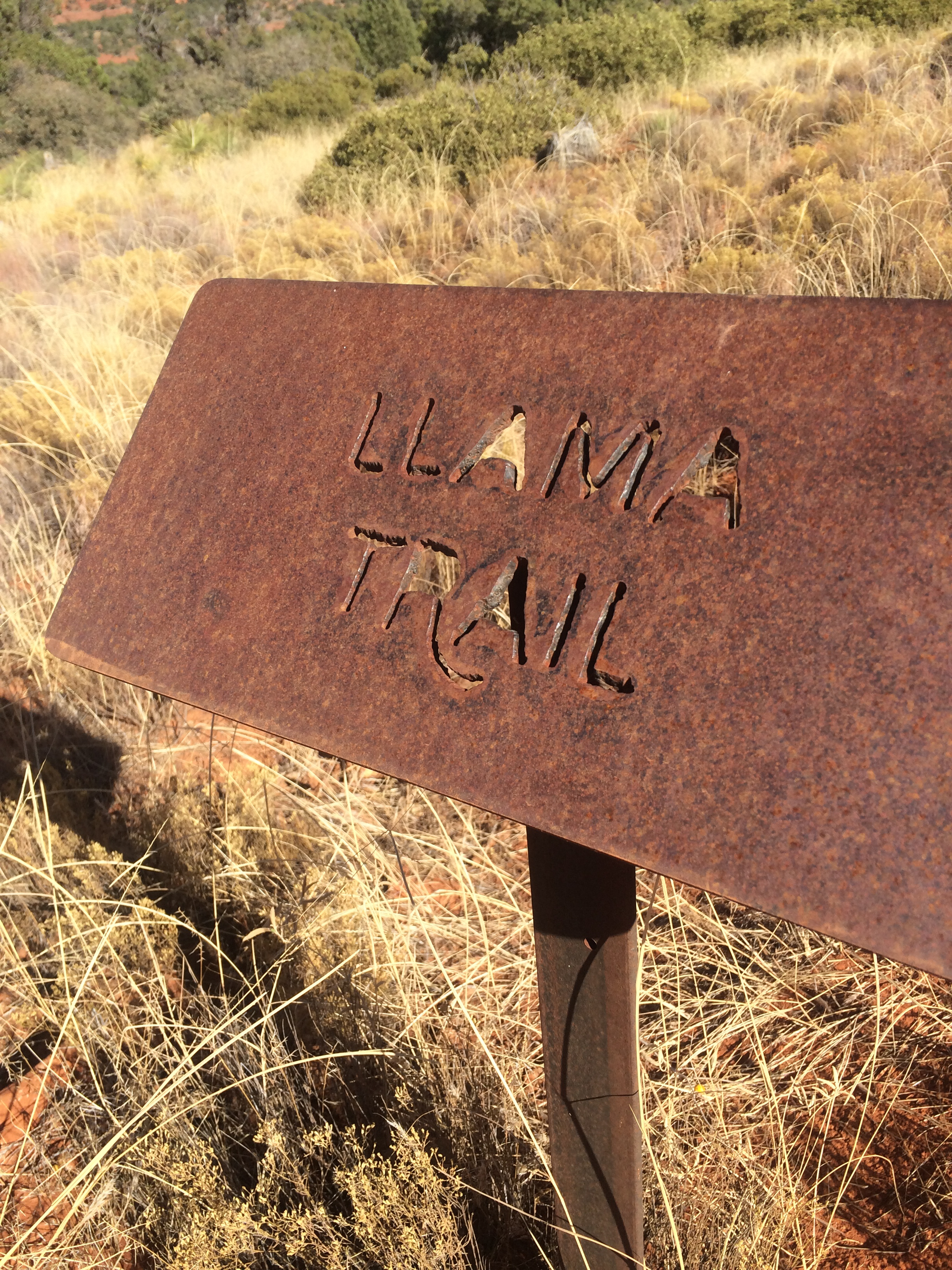
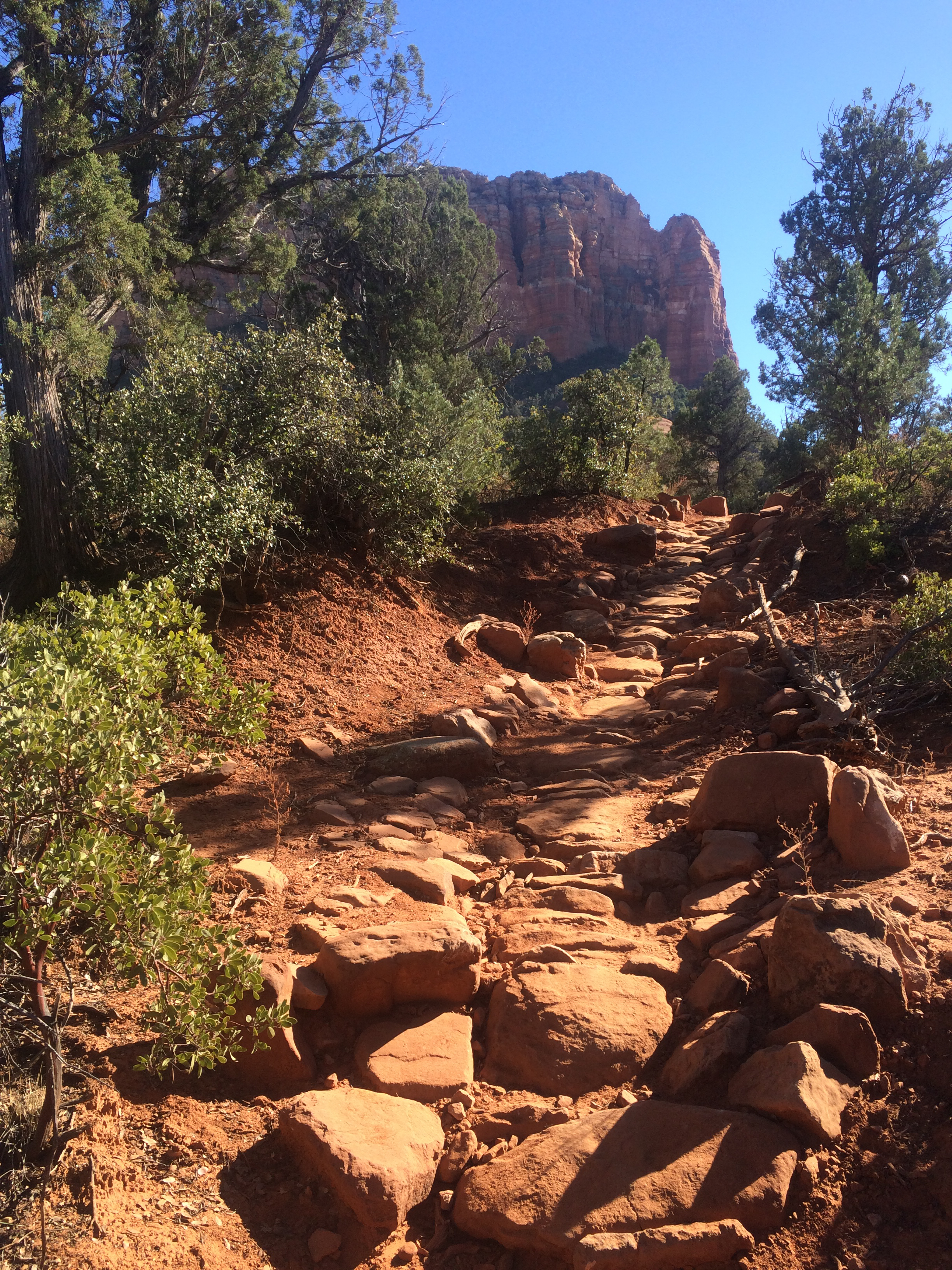
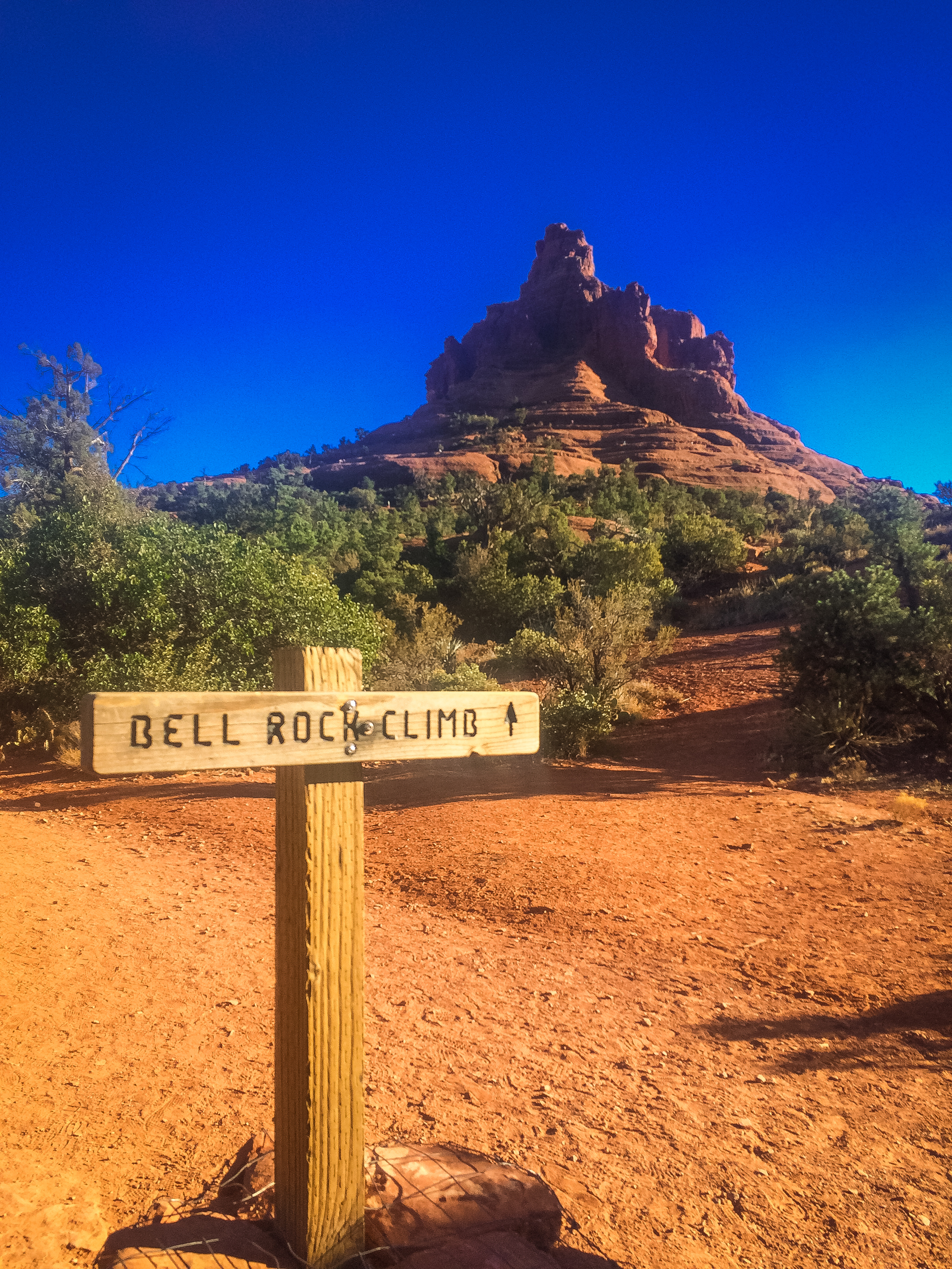
One of the best things about Sedona, besides the beauty around every turn, is the fact that there are so many trails we can take off in two different directions and both get what we are looking for. Bob on his wheels, and me on my feet - a great day for both.
Spent the day traveling along Hwy 95 in search of ruins from the Anasazi period. Found three sites that gave us a wonderful representation of this period of history.
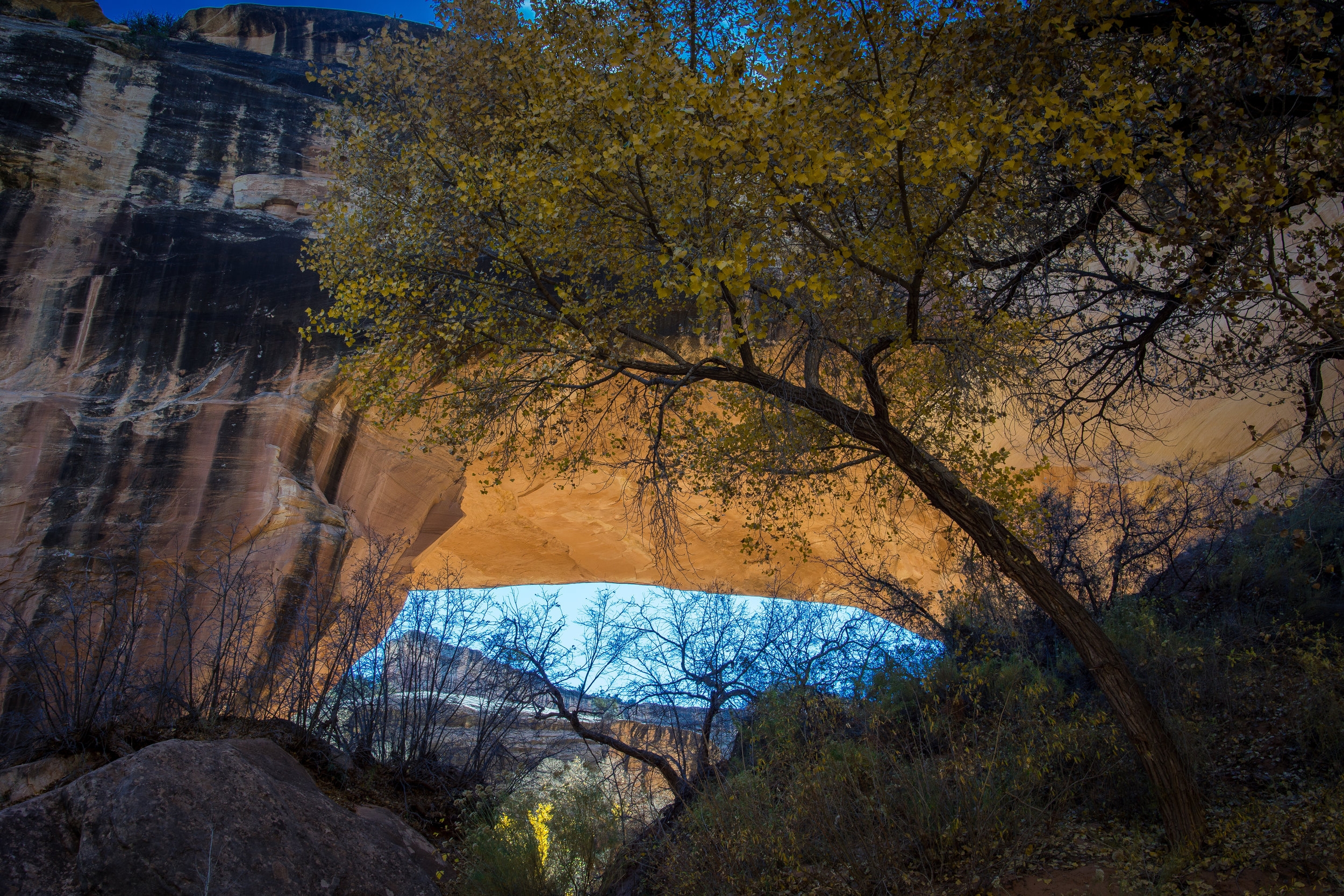
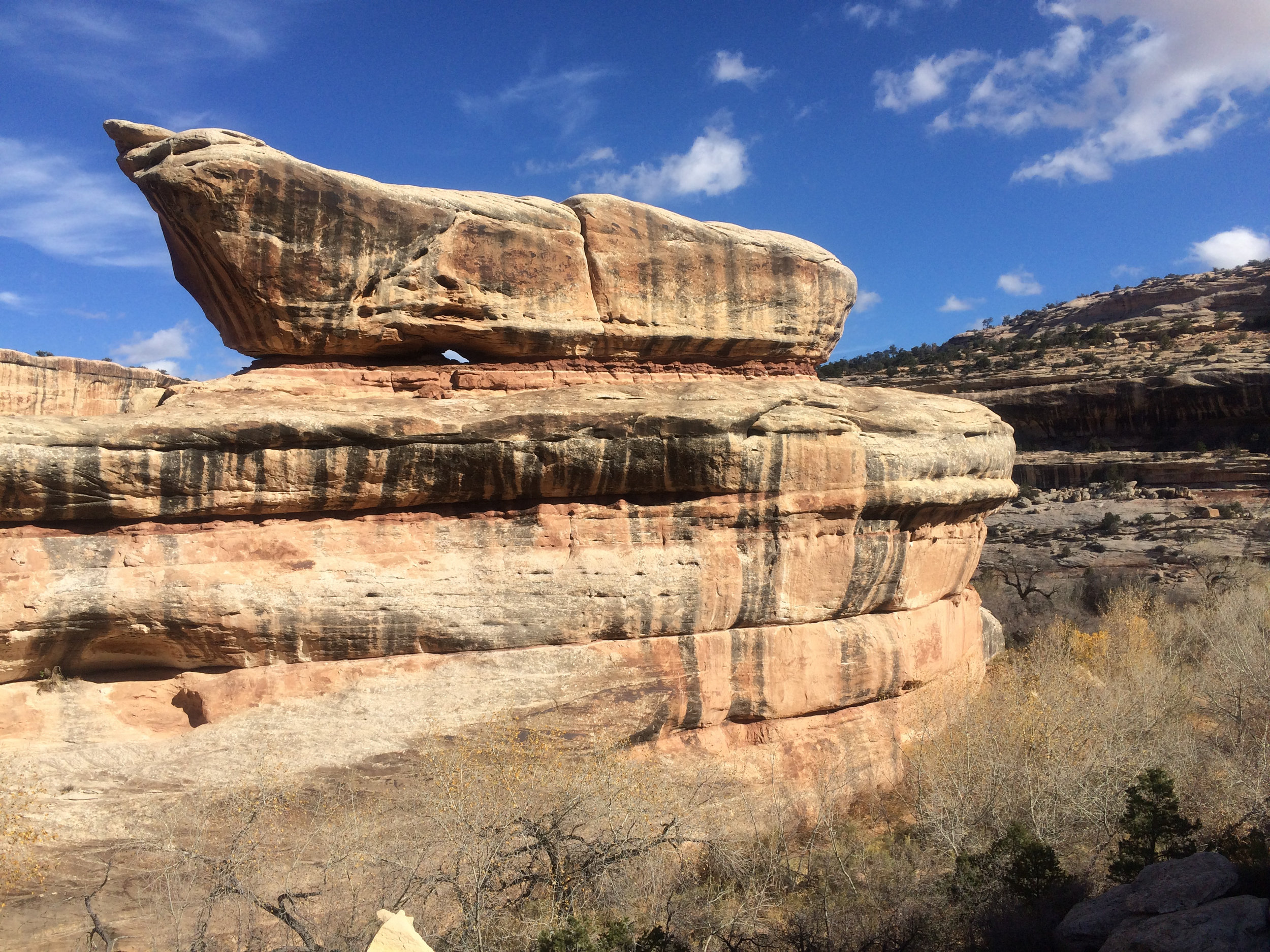
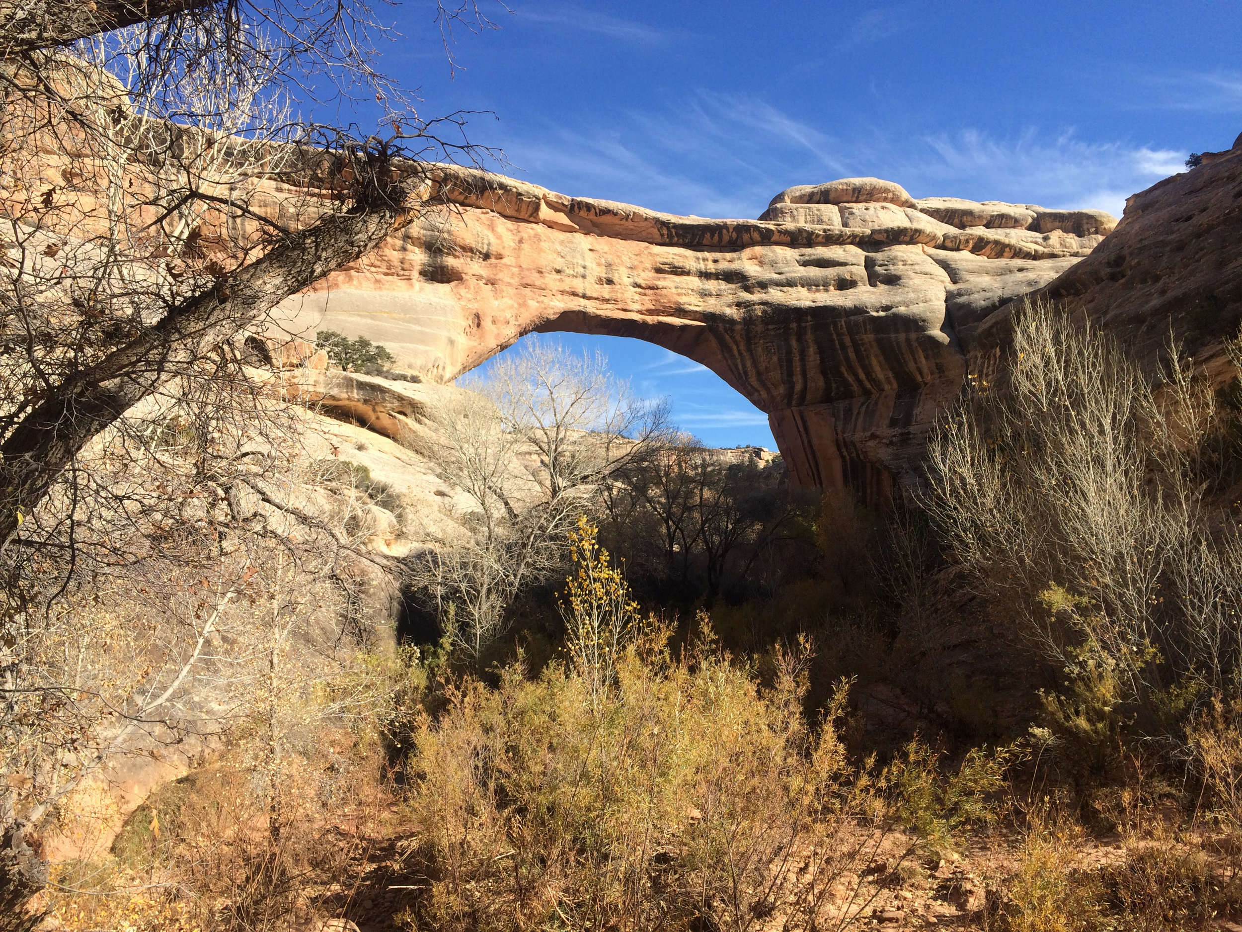
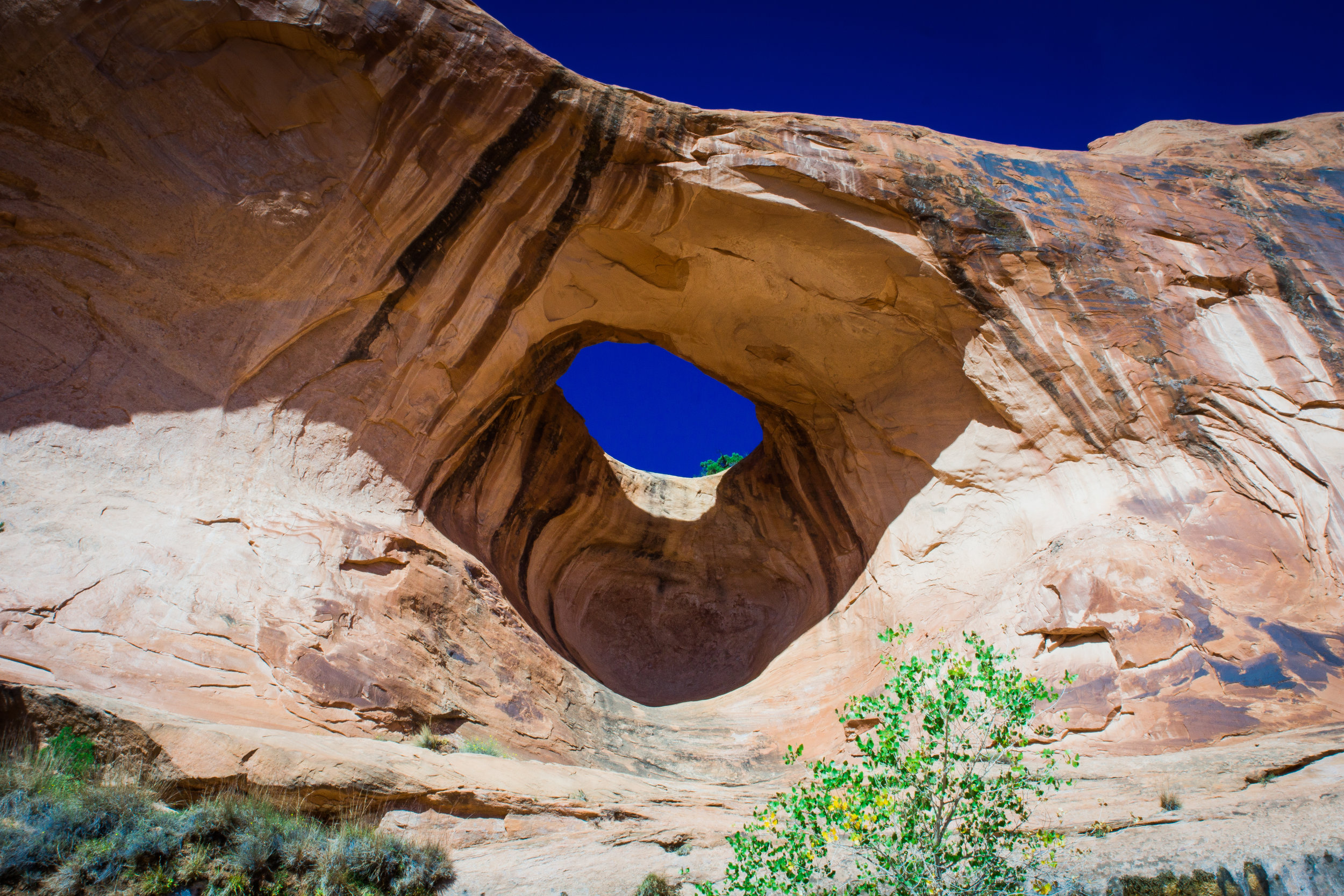
Kachina Bridge 210' high, 204' span, 44' wide, 93 feet THICK
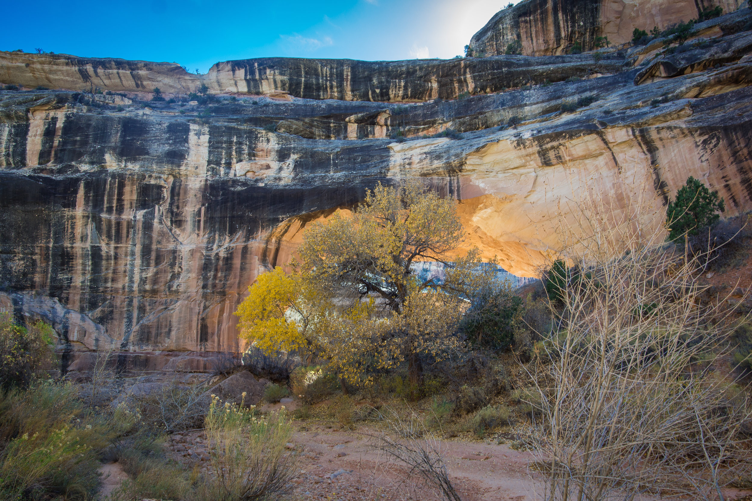
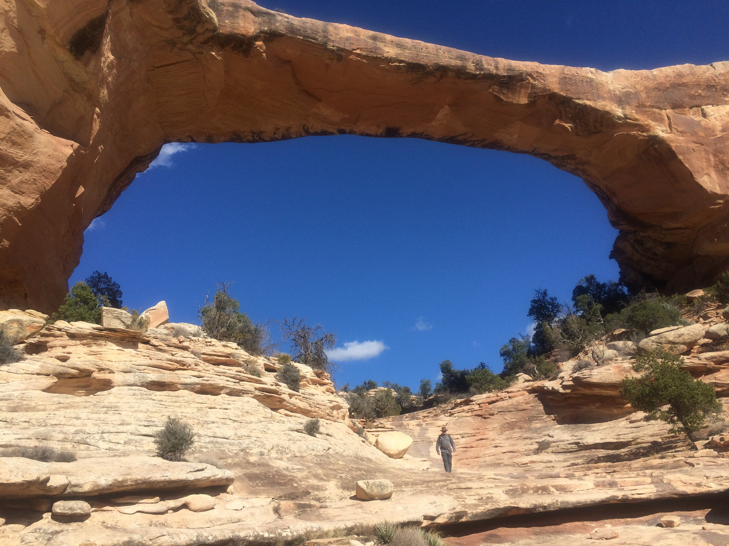
This one ranks right up there as one of our favorite, and hardest hikes so far this year. Located inside Bear's Ears National Monument, Natural Bridges was discovered by a prospector, Cass Hite, in 1883. It wasn't until 1904 though that the discovery was publicized in National Geographic, and in 1908 President Teddy Roosevelt proclaimed it to be a National Monument, creating Utah's first National Park System area. THANK YOU Teddy Roosevelt!!! The bridges have had a few names over the years but in 1909 they were given Hopi names to better reflect the area's history and culture.
About a 45 minute drive from where we are boondocked north of Blanding, we stopped at the visitor center and picked up a map of the park and asked about the hiking trails. We knew we didn't want to do the "drive-walk to edge-look down into canyon at bridge-get back in car" thing. We wanted to be able to get down under the bridges to truly experience the magnitude of them. The volunteer gave us some great info and off we went.
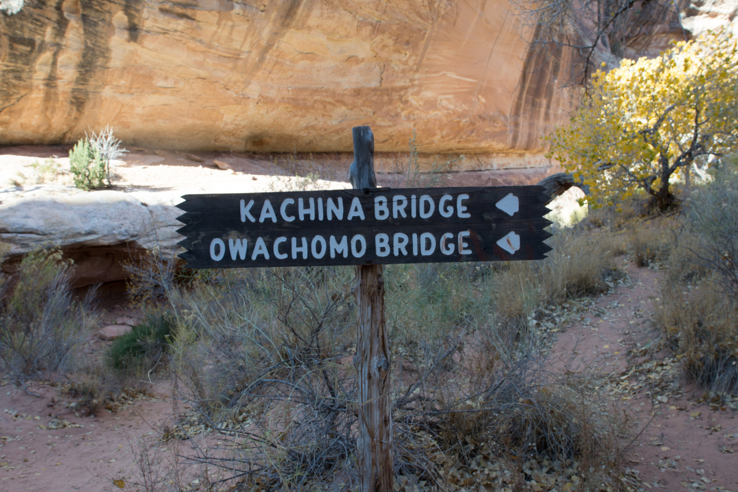
We drove to the farthest bridge, Owachomo, which means "rock mound," parked and got all our stuff together and set out. We knew it was going to be about a 10+ mile day, and it was warm, so lots of water and snacks came with us.
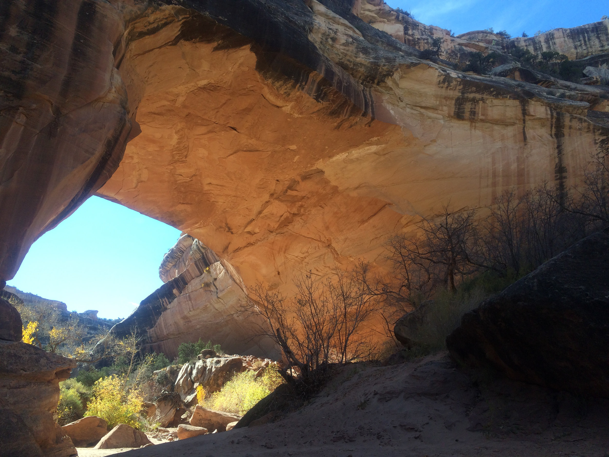
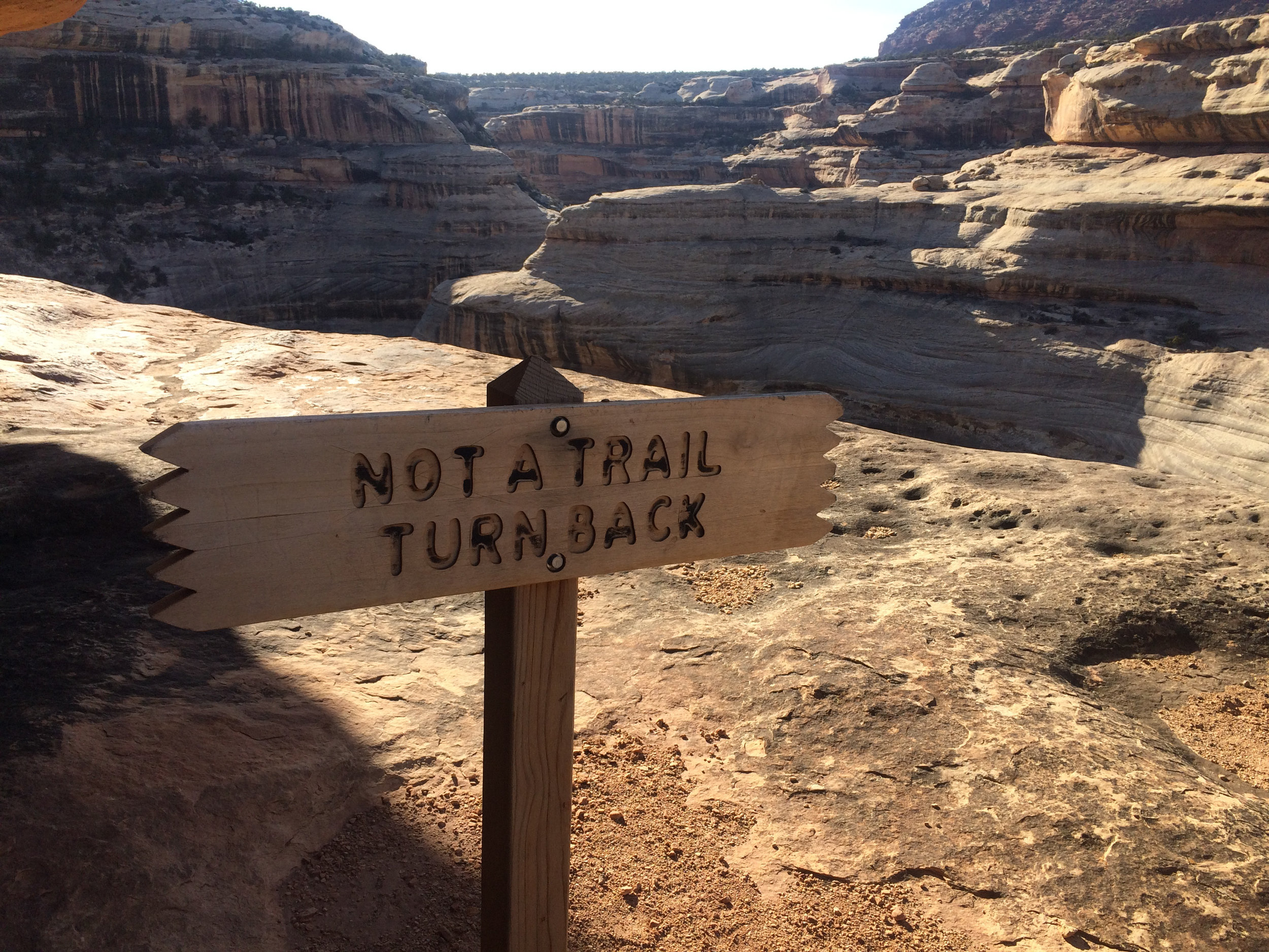
Bridges differ from arches as they are caused by the erosive action of moving water, where arches are caused by other erosional forces - frost action, seeping moisture. A nice gentle sloping 180' down over large slickrock took us to the bottom of the canyon. We were under Owachomo, the first of three bridges we would explore on the hike. Somehow - this is where I should explain that neither one of us were really paying attention when we got the map - we were hiking the canyon in a clockwise direction, when we should have gone out over the top of the mesa a few miles, then dropped down into the canyon at another bridge and walked the 7 or so miles back to the car. Climbing out at Owachomo (180').
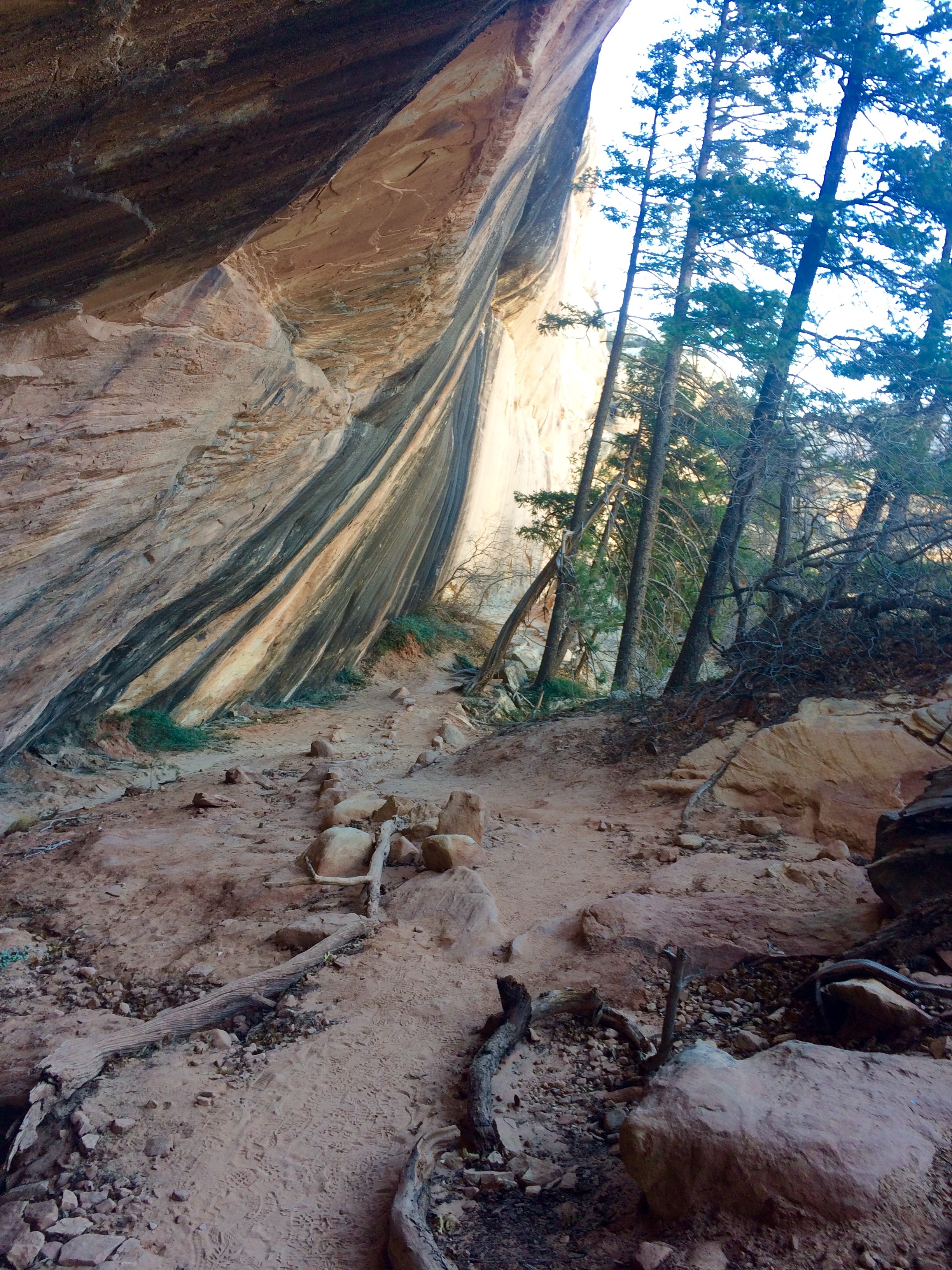
We never saw a soul on the trail until about 4 miles in. After stopping and talking with fellow hikers, we realized what we had done, and that we got to look forward to the 500'+ climb back out of the canyon at the end. Didn't spend too much time thinking about it because the beauty that surrounded us overtook our senses. The canyon was filled with towering cottonwoods just turning vibrant yellow, tall sagebrush, junipers and cacti.
We came upon the second bridge, Kachina, named for rock art that resembles symbols commonly used on kachina dolls, and wandered around the base with our mouths open in awe. It is massive, 210' high/ 204' long and 44 FEET across the center and 93 FEET thick! When you stop and think about the water that flowed under this bridge to create it...well it is mind blowing to me.
We continued up the canyon crossing the dry stream bed over and over as our shoes filled up with the fine red sand that makes up most of the trail. I kept looking up at the canyon walls that rose above us and thought "yep, at some point we have to climb UP and OUT of here".
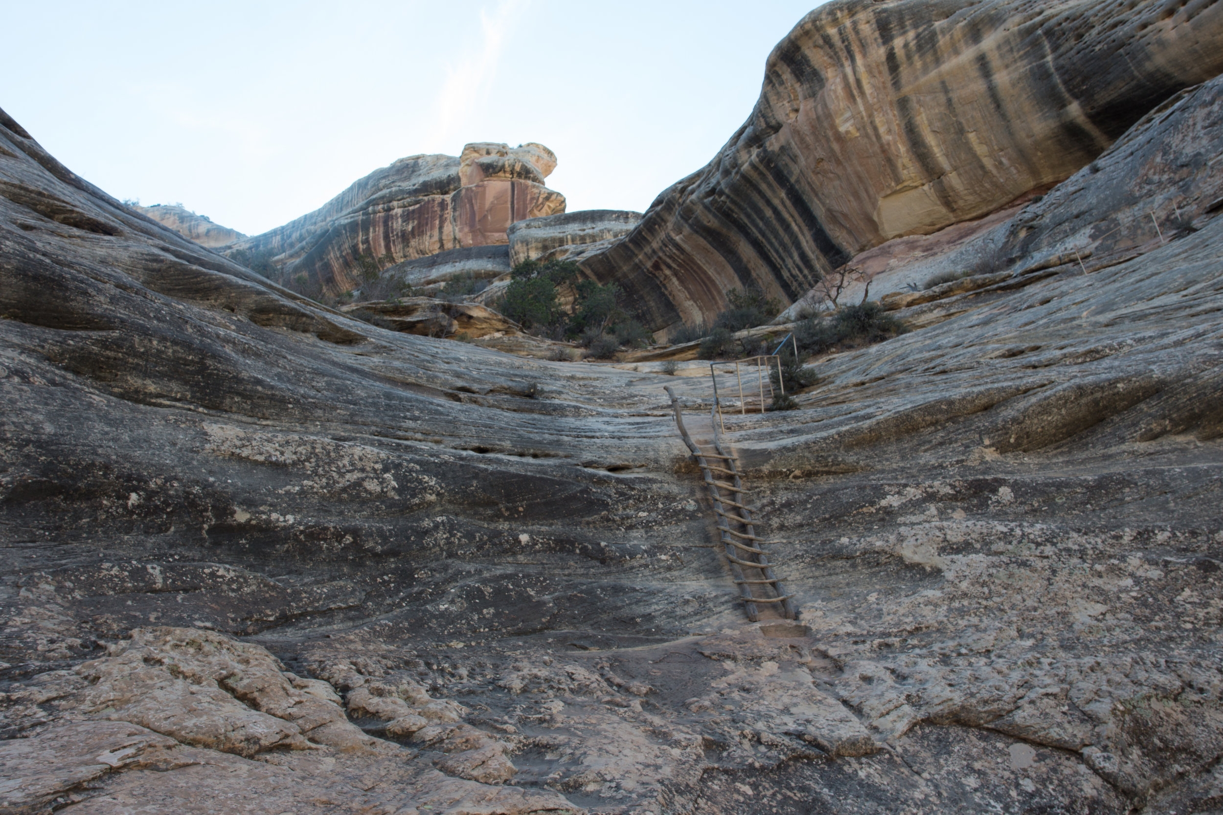
We arrived at the last bridge, Sipapu, which means "place of emergence," and I thought how fitting! We were going the right way after all, we were going to EMERGE out of the canyon at just the right spot. Then....I saw the way up.
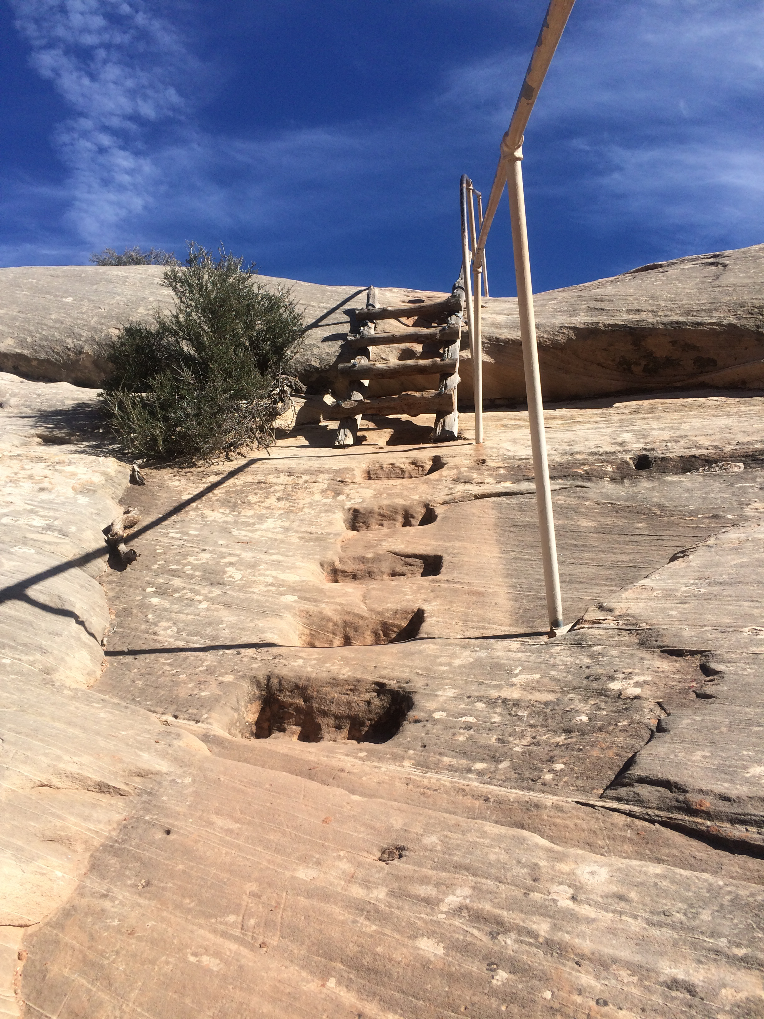
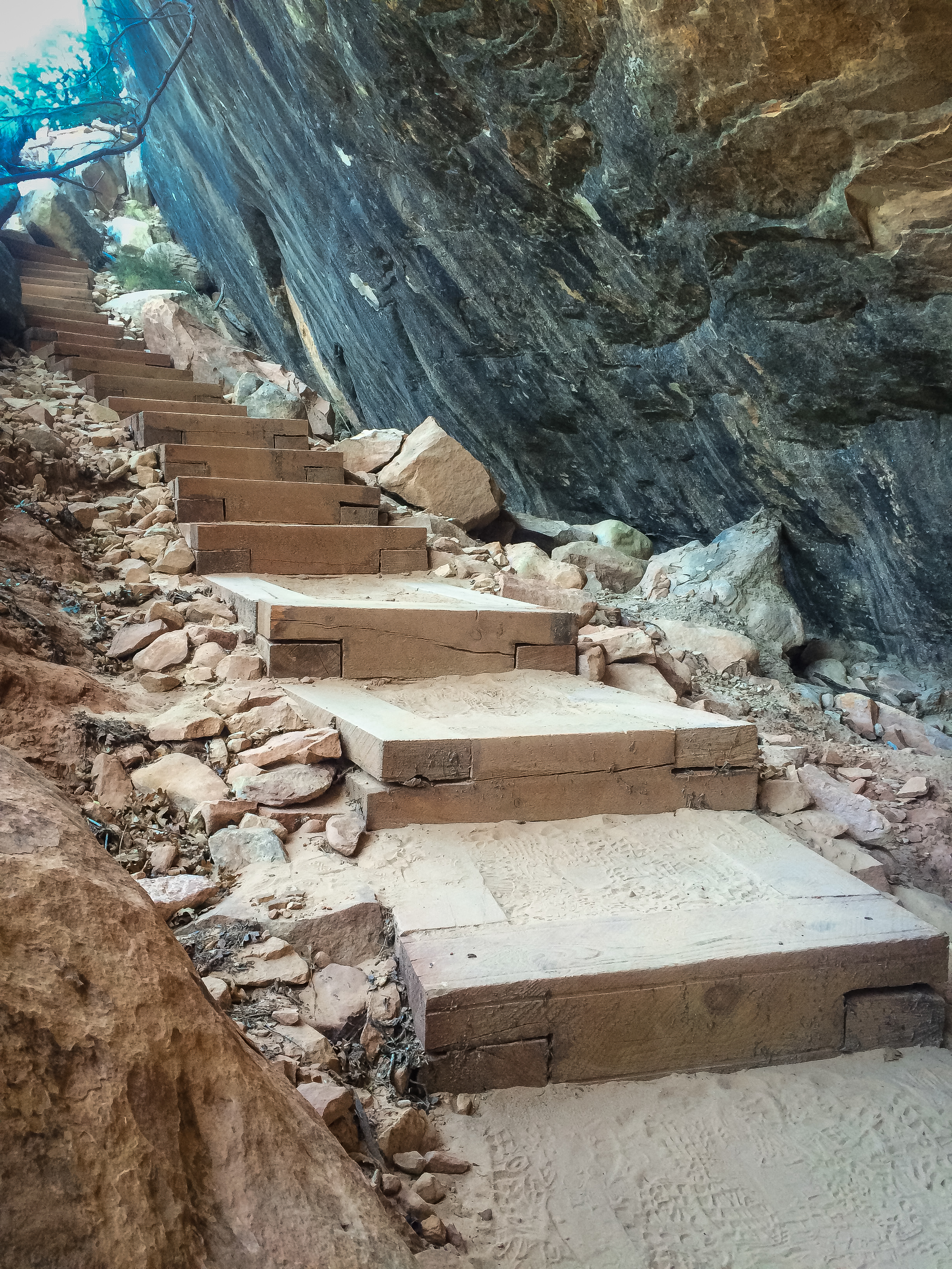
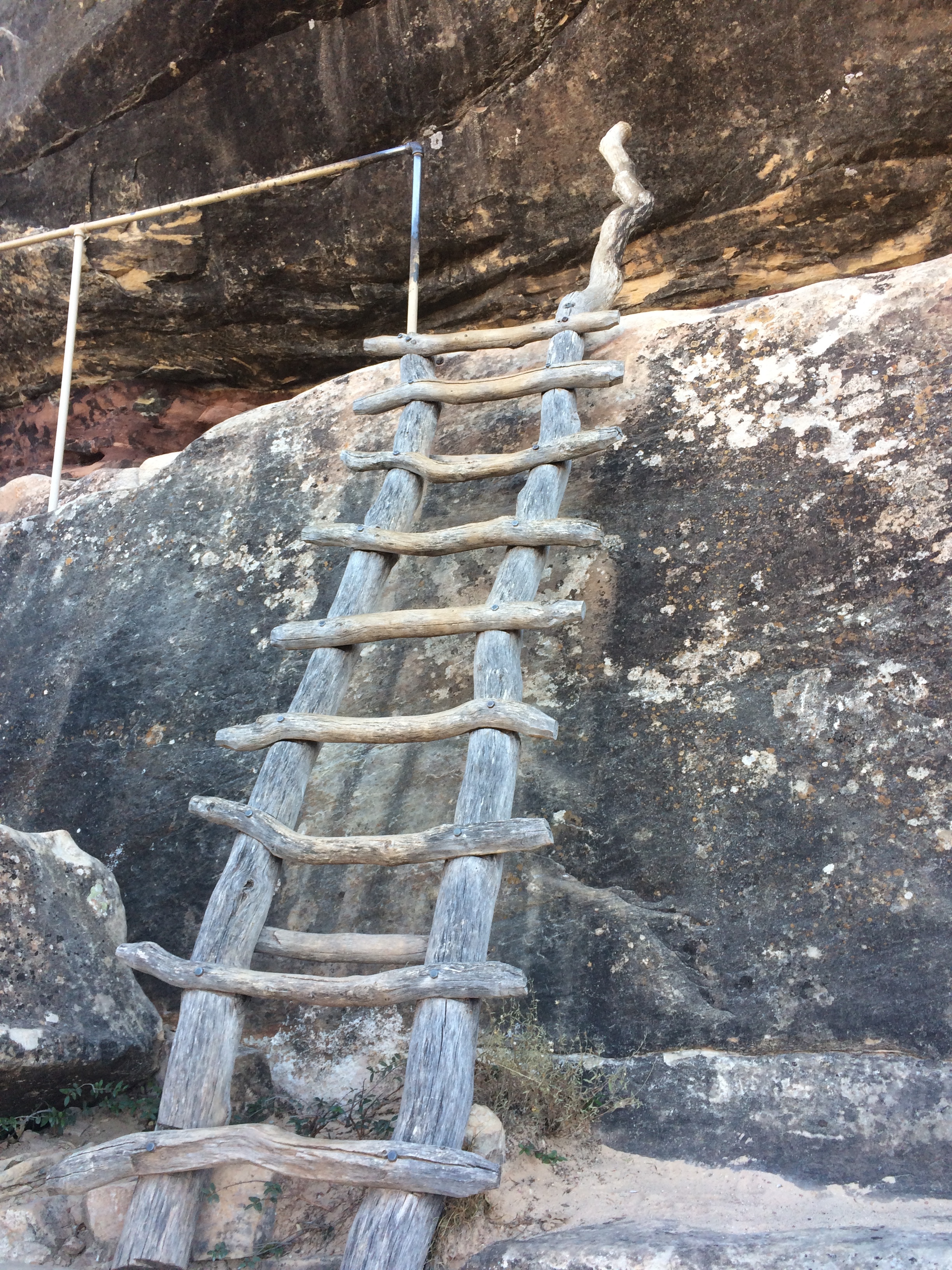
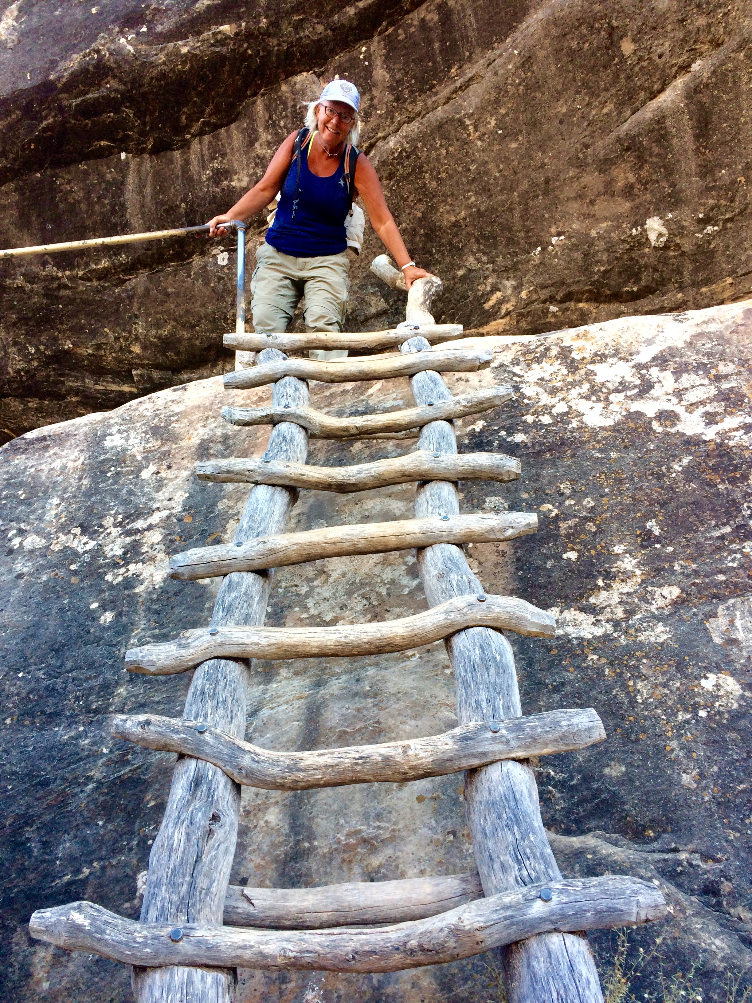
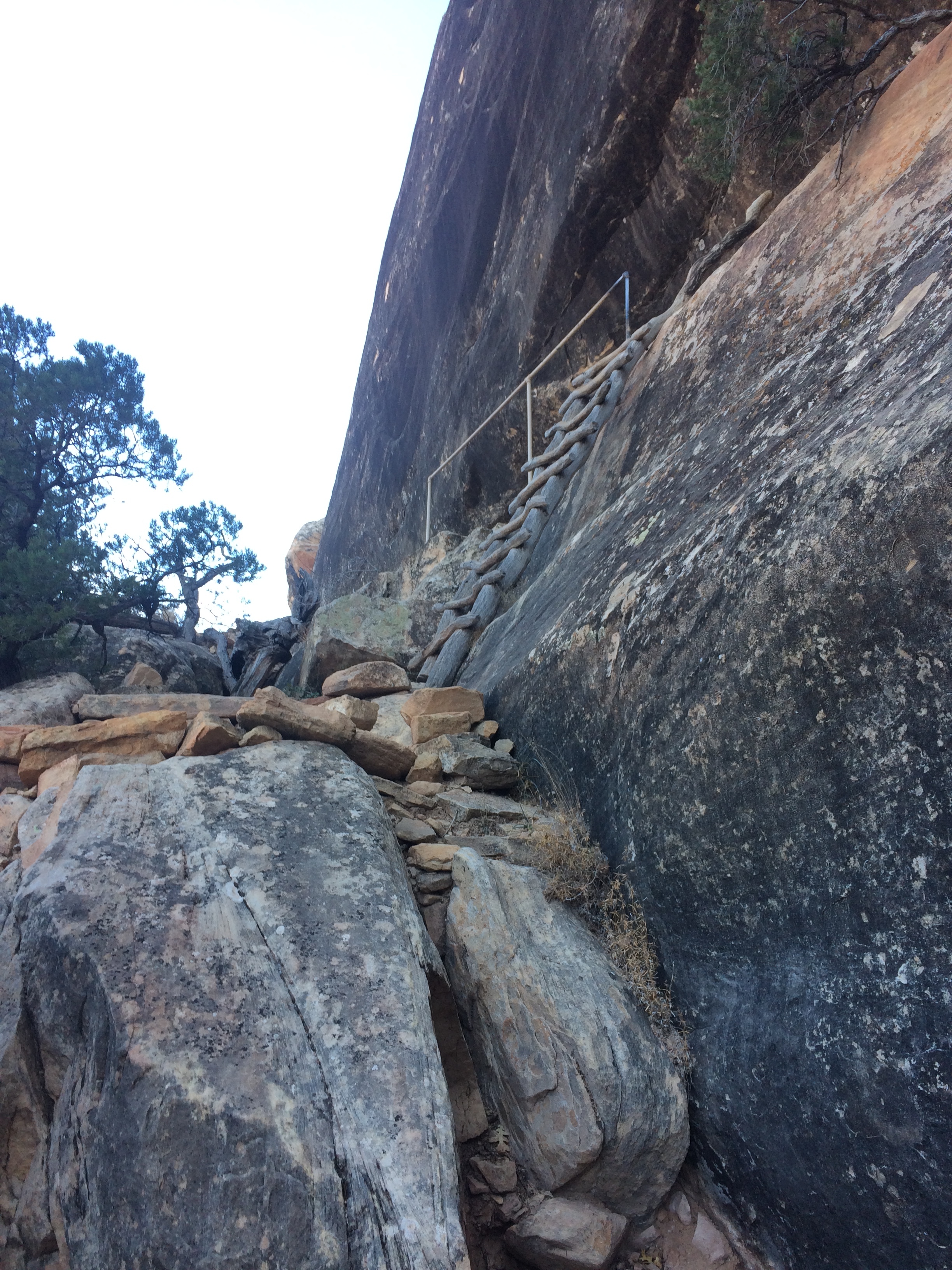
I am not good with heights, but I have gotten better. It takes me awhile to climb straight up, my breathing takes time to catch up to what my legs feel they can do. But up..uP..UP we went. Using the handholds and ladders placed into the rocks, THANK YOU PARK SERVICE, we scrambled and made our way up the 500' face of the canyon. Feeling a profound sense of accomplishment when we got near the top, we sat and gazed out over the canyon, feeling thankful that we had taken the direction we had. Bob and I both agreed that going DOWN the 500' would have been extra hard on his knees, and on me - because I would have had to actually see how high up we really were and what the drop off was going to be.
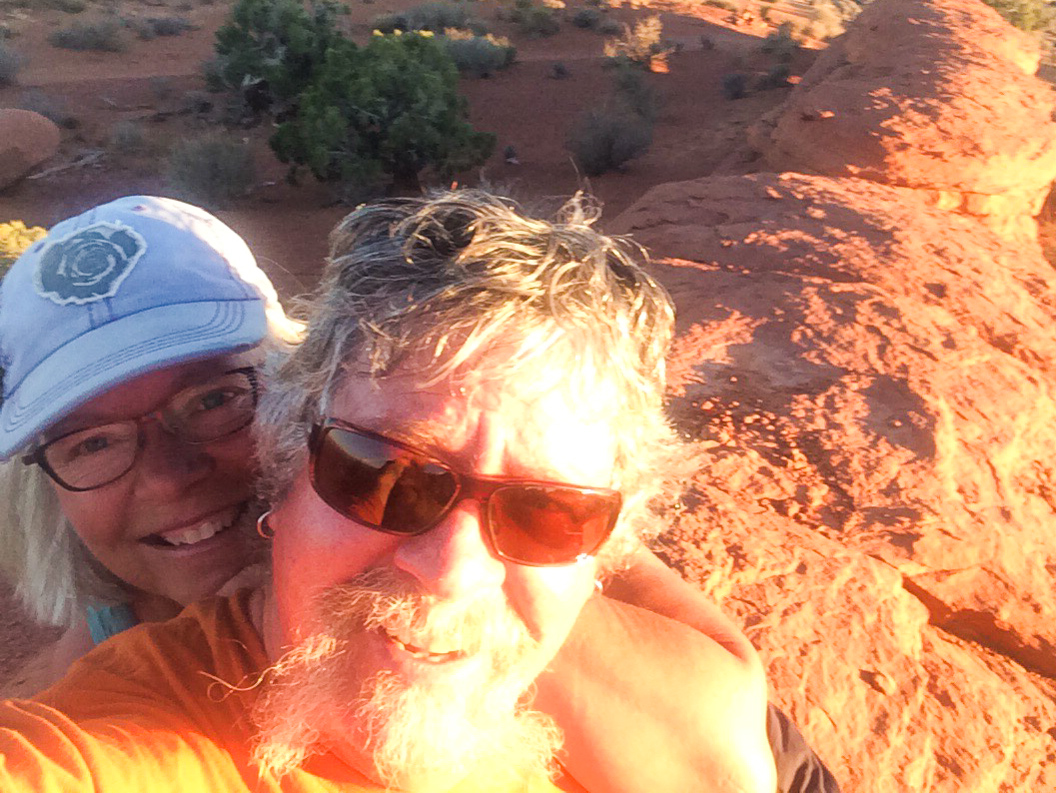
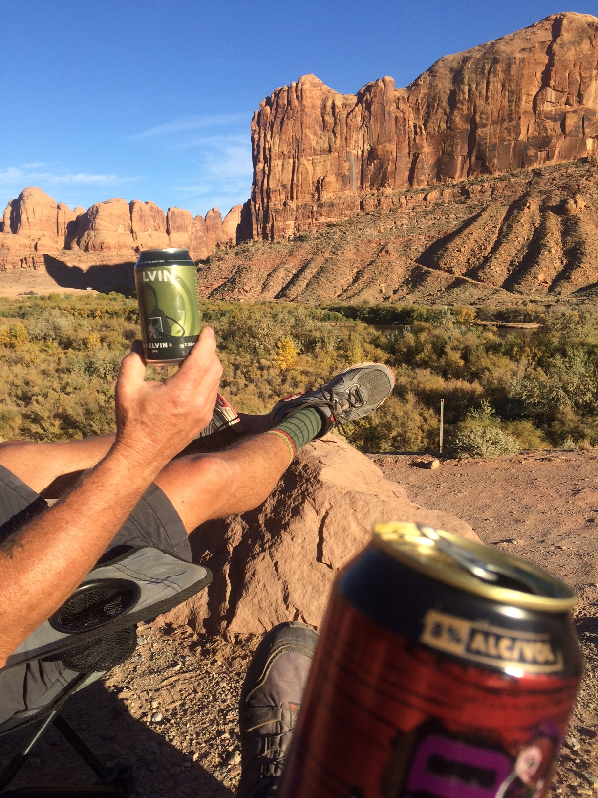
When we got to the top we set off across the mesa back to our jeep. The three miles or so was very different than the canyon. This area was filled with slickrock and tall juniper. Back at the jeep we collapsed in our chairs, got out our adult beverages and settled in for the sunset. Beautiful day, beautiful hike. Once again so thankful that those that came before us had the foresight to preserve these natural beauties for us to enjoy a hundred years or so later.

Finding our Space
We left Moab after an amazing three weeks and hit the road south towards Blanding, UT and Bear’s Ears National Monument. Bob had found us a place through freecapsites.net and it sounded ideal. We were only moving about 70 miles this trip so it was definitely going to be one of our shortest moves ever, but it would put us right in the heart of the monument.
Bear’s Ears is massive, covering over 1,351,849 acres of public land. There is quite a bit of controversy surrounding the designation of this area, and I am not going to get into the pros and cons and politics here. What I will say is that after spending a month in this area, we have changed some views….in both directions. Do some research, visit and spend time here. Get to know some of the local people and listen to their thoughts. You will be rewarded in many ways.
We knew that we would need a more centralized location to be able to visit many parts of the monument over the next couple weeks. The directions to get to our spot were a little vague, and we took the wrong road into Recapture Reservoir. Luckily, we had room on the dirt road to unhook the jeep and turn the motorhome around. Drove up to the south end of the lake and I went down in the jeep to check it out while Bob stayed up top. GOOD THING! The dirt and large rock filled road was sketchy even in the jeep, and the straight drop off down the side of a cliff didn’t help. I found a place to turn around and came back up and met Bob at the top, so thankful that he hadn’t made a decision to follow me. We went on into the town of Blanding and stopped at the visitor center and had a great chat with the volunteer. He got us headed in the right direction and we found the wide paved road that led down to the lake. (directions below). Set up camp right near the water, cottonwoods gently blowing in the breeze and the signs of deer prints all around us. We were the only ones there and we watched as the sun set over the lake through the bright yellow leaves of the trees.

The next morning, we decided that we would go ahead and leave the bus there and go exploring. Quickly we realized that it was at least a 75-mile round trip sort of day each time we ventured anywhere. Blanding put us central to what we wanted to see, and the only other boondock area we came across would have put us close to one area, but 125 miles from others.
Over the next week we ventured to Natural Bridges National Monument, Newspaper Rock, Canyonlands, Elephant Hill, Mule Canyon, House on Fire and more. Pics and posts on those to follow.
Hints: The reservoir is great for any size rig.
Directions: If coming from the north on Hwy 191, GO PAST the actual lake and then take the first right after you go around a small mountain. The road is “Radio Hill”. Follow the paved road to camping area. There is a dumpster there, and also a pit style toilet.
From the south, go approx. 5 miles north of Blanding, watch for the Napa on the right, then look for the brown sign that says “Recapture Reservoir Recreation Area“. Turn left on Radio Hill road. Follow the paved road down to the camping area.
Blanding: The museum was lovely, and the volunteers extremely helpful. Once we explained what type of hiking we were looking for, and our ability levels, they got out all kinds of hand drawn maps that they had made themselves and gave us great descriptions and ideas for hikes. They also have a fast free wireless, and a small room where you can plug in and charge and work if needed.
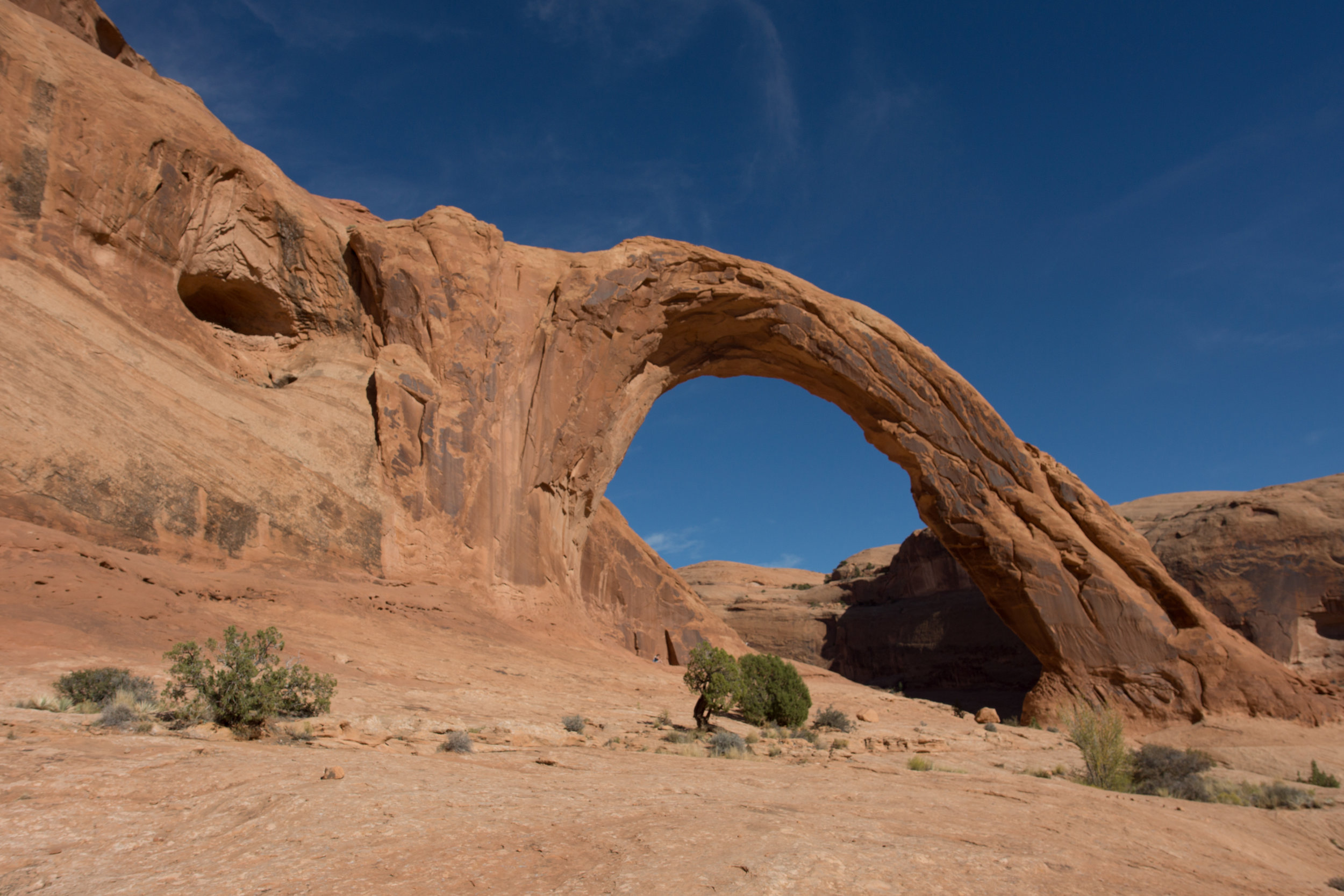
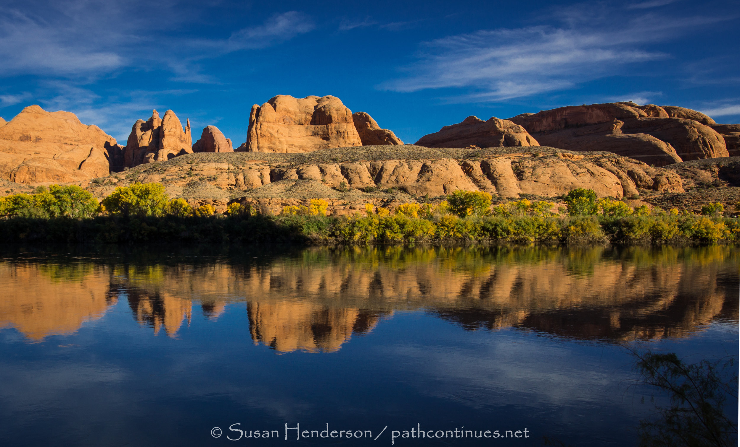
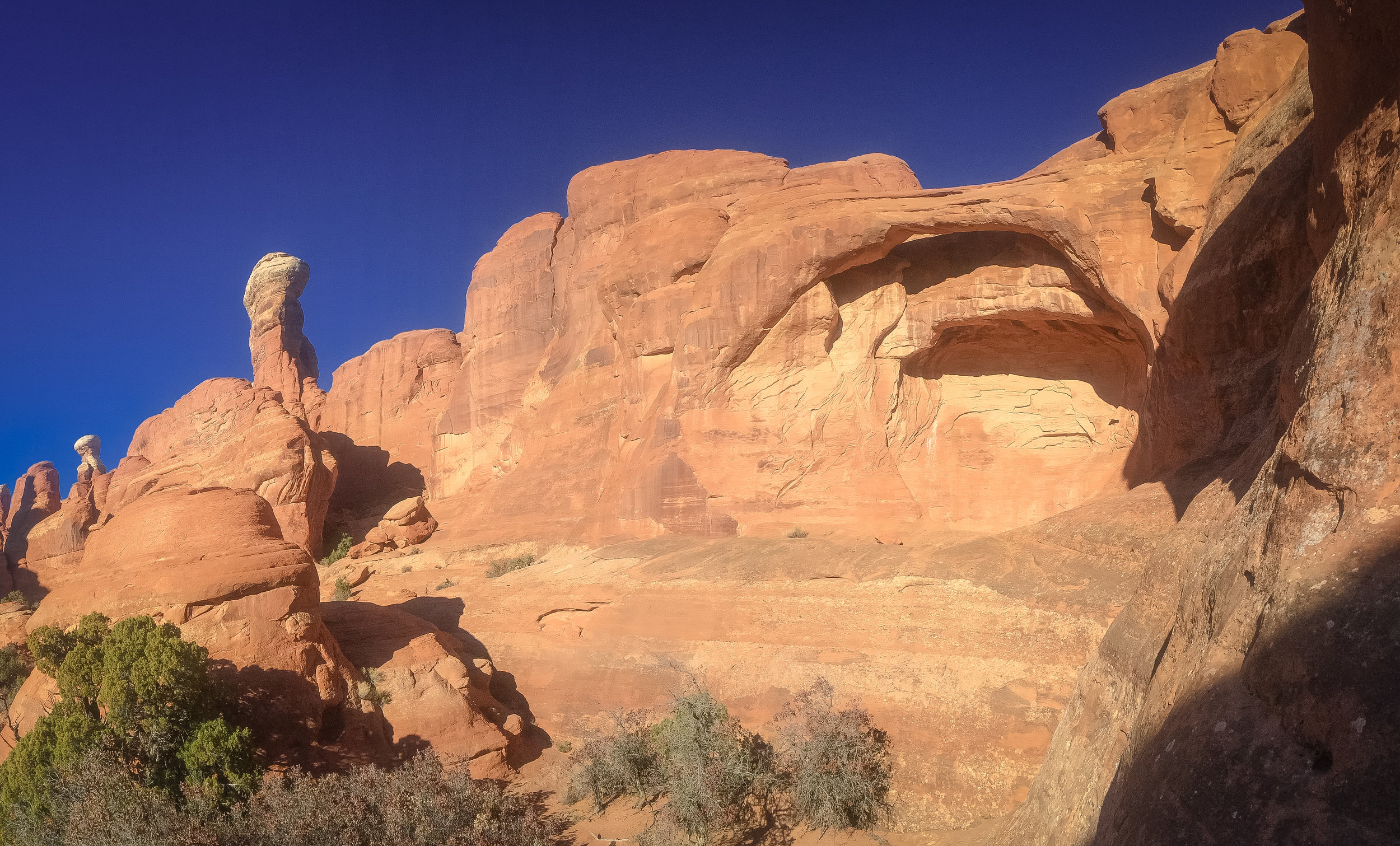
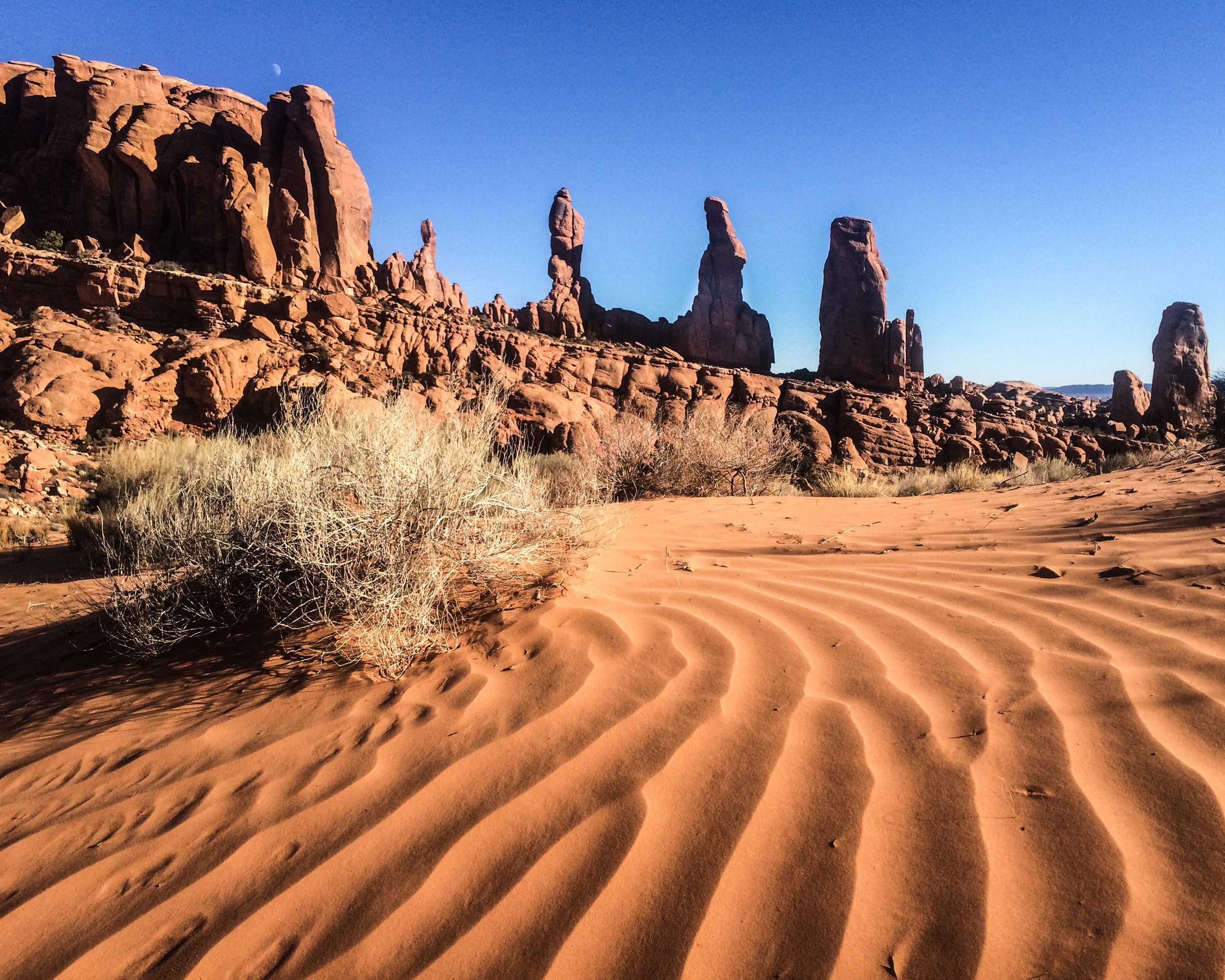
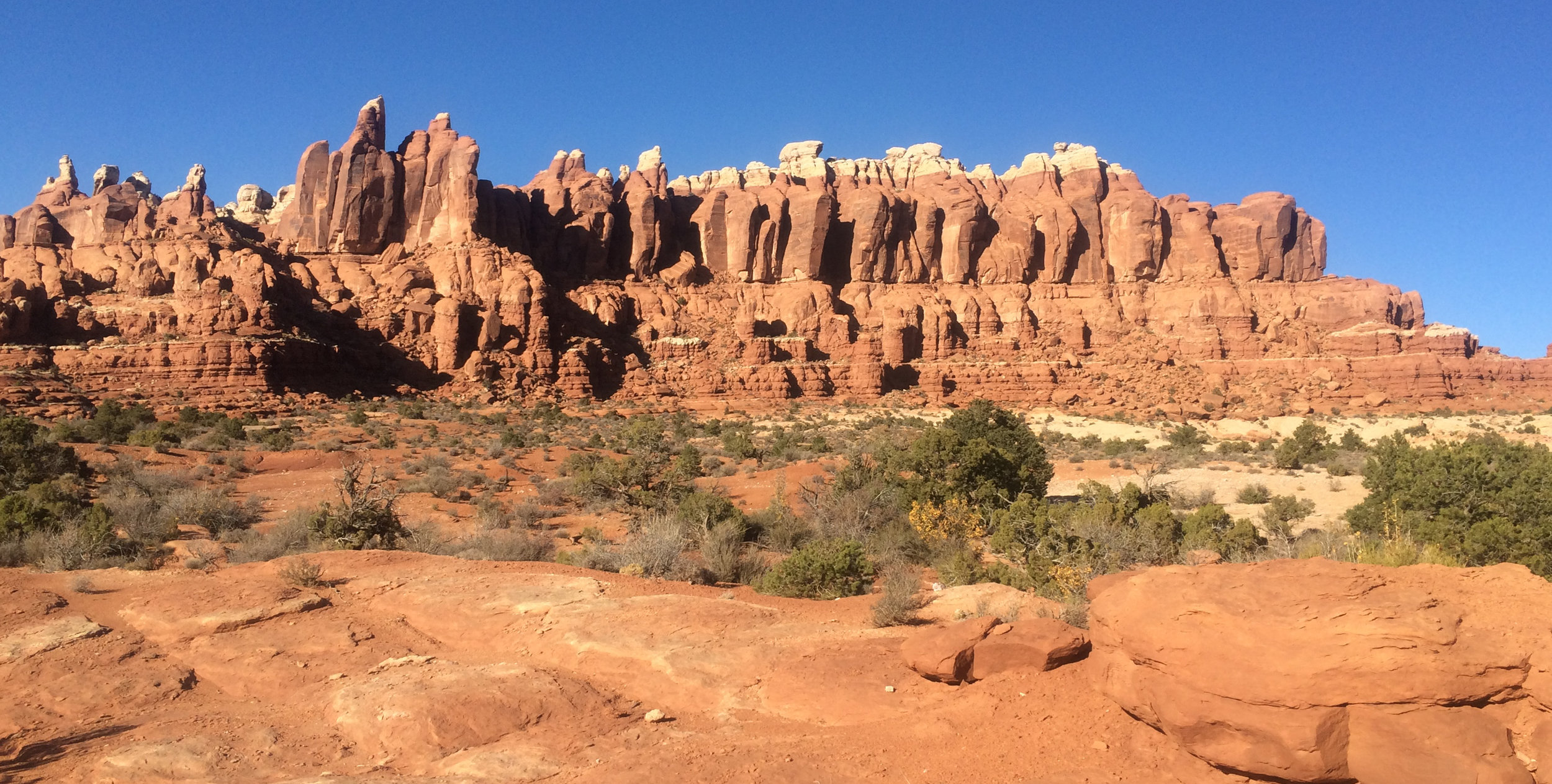
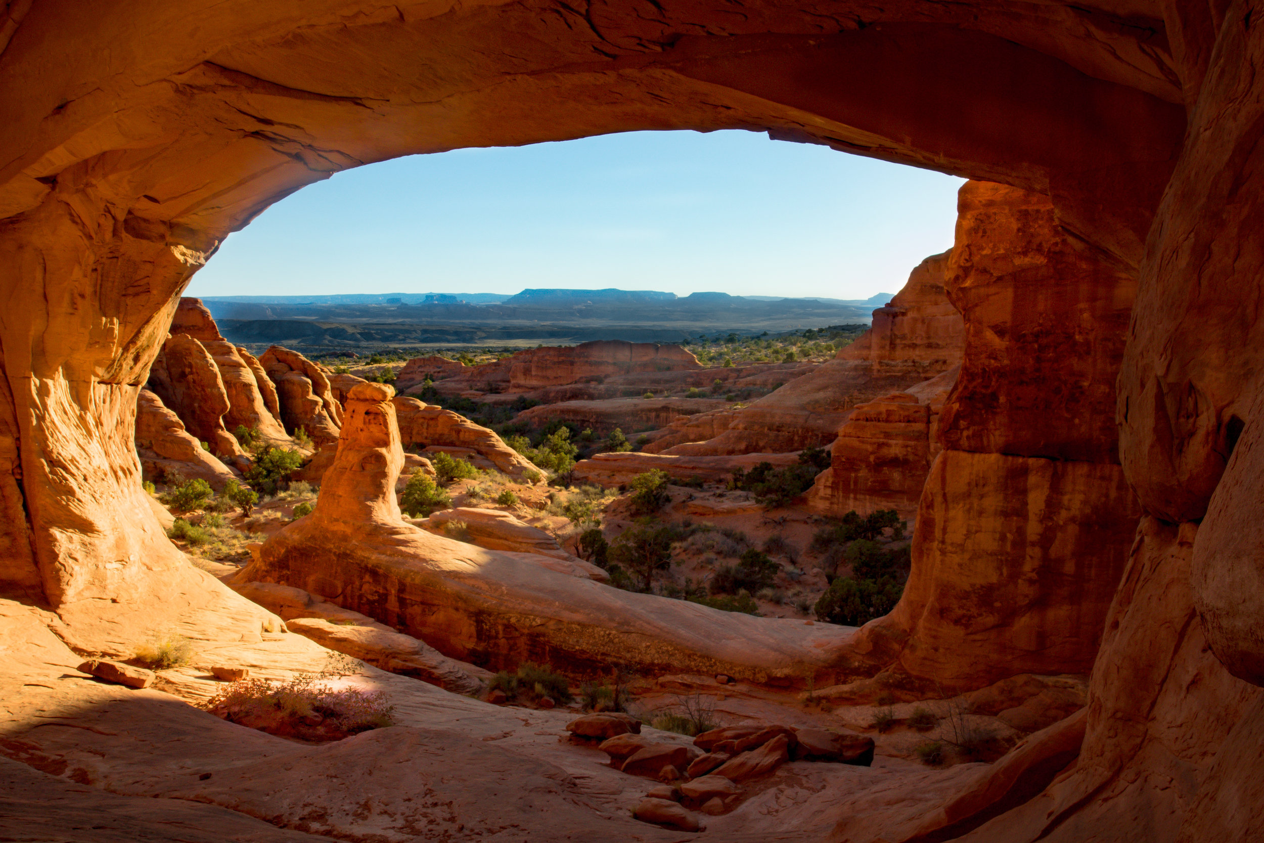
One of our favorite, and toughest hikes, in Moab this year was to Tower Arch. I don't know if it was the extremely warm day, or the fact that I had already hiked to three other arches before this one, but it was a long one. We entered off the paved road through the park instead of taking the 4-wheel drive road from our campsite area. The hike in was soft sand in parts but mostly sandstone rock. The Marching Men formation so accurately described the towering sculptured rocks. Around a few more corners and we arrived at Tower and we made the decision to see if we could get up in the arch to get the "window" shot I had seen in others photos. So glad we did. Another great day in Moab.

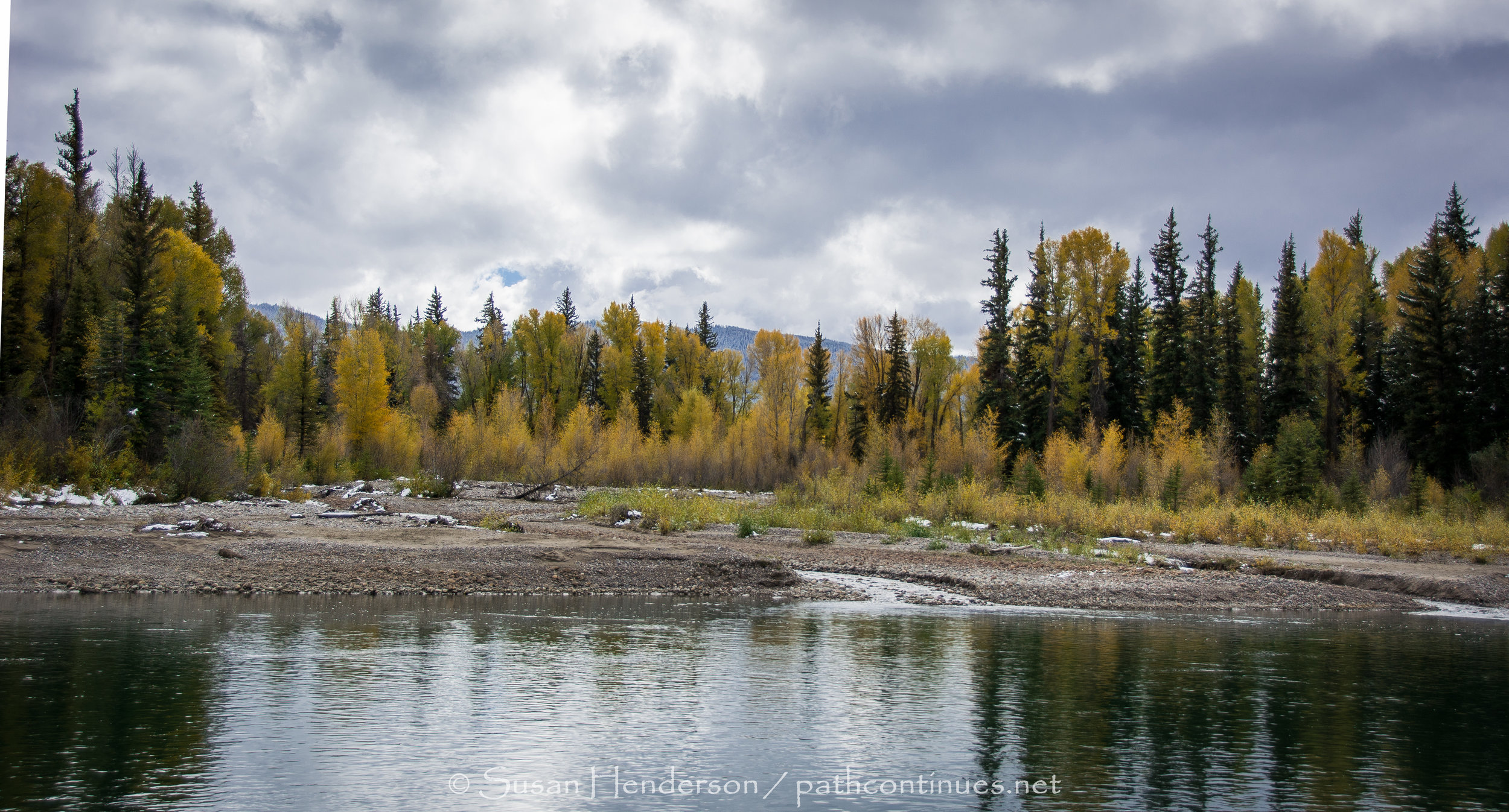
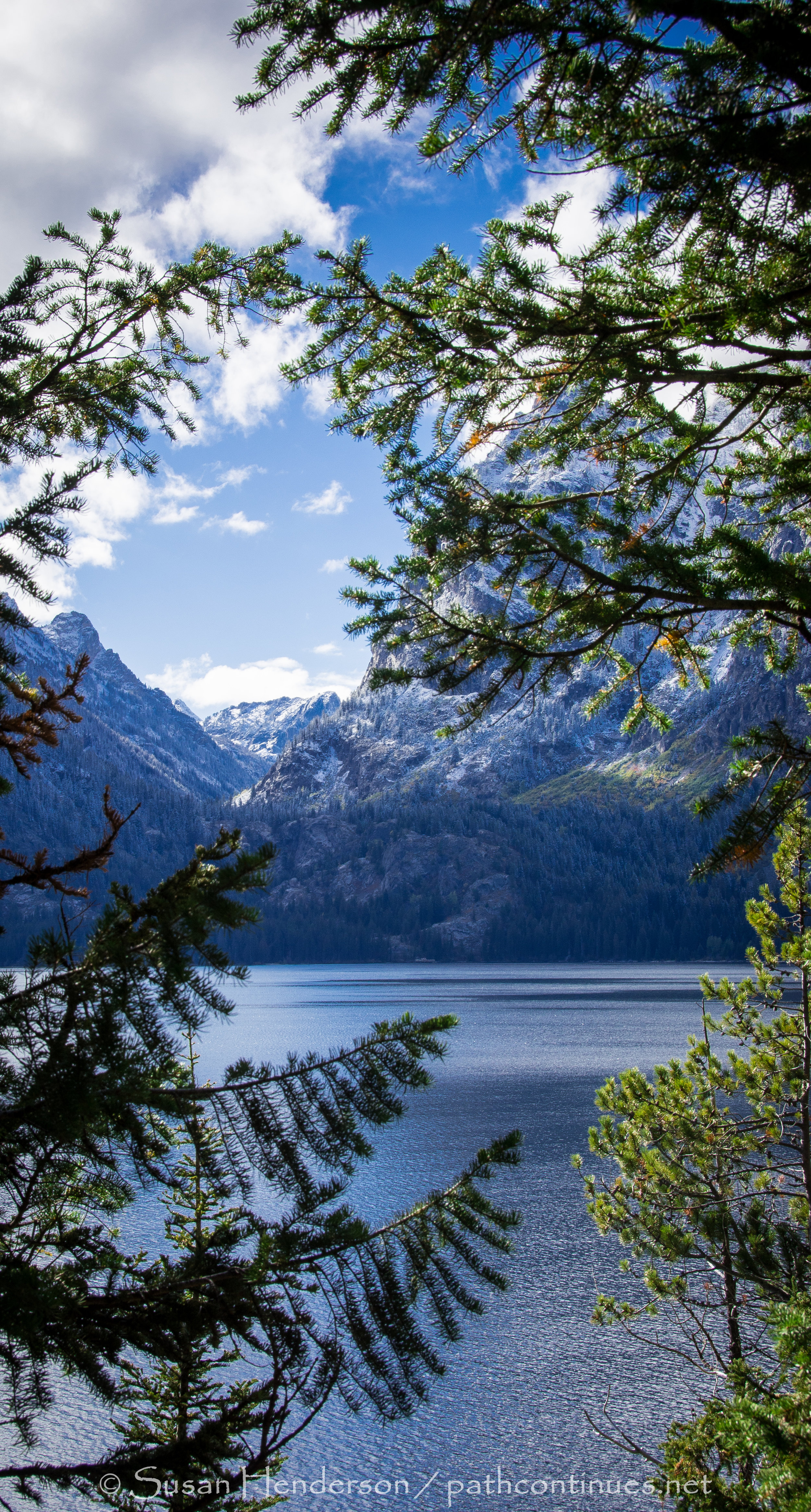
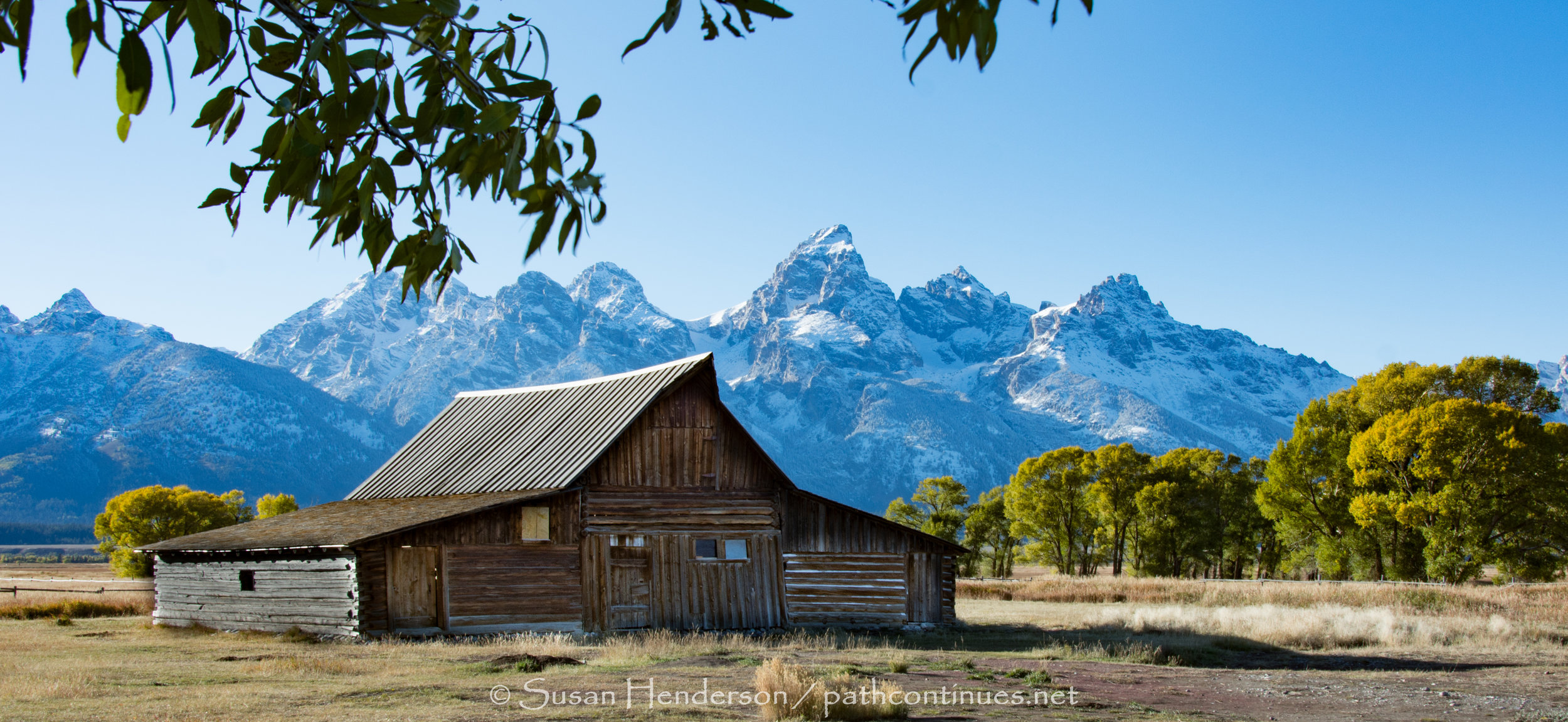
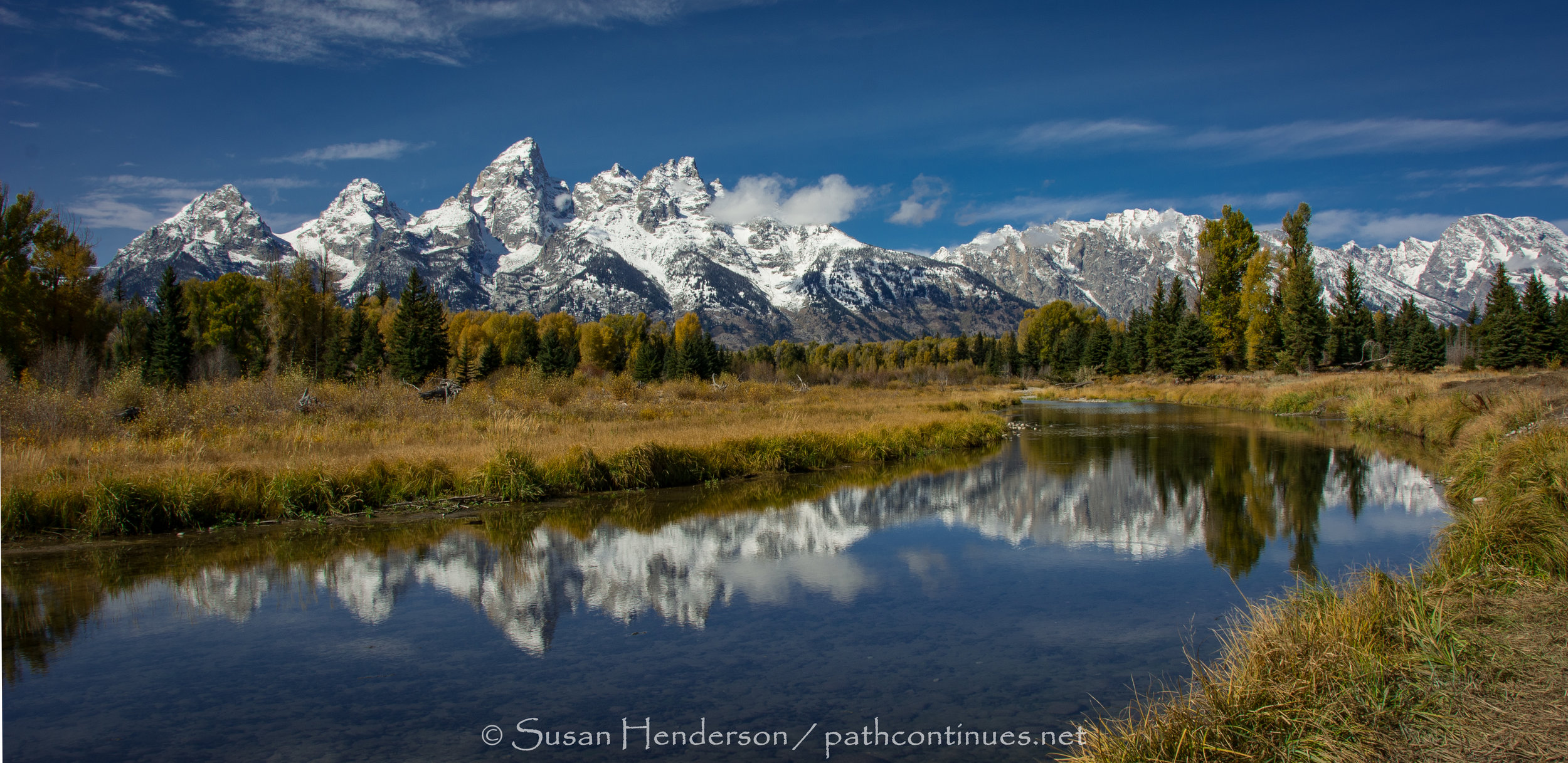
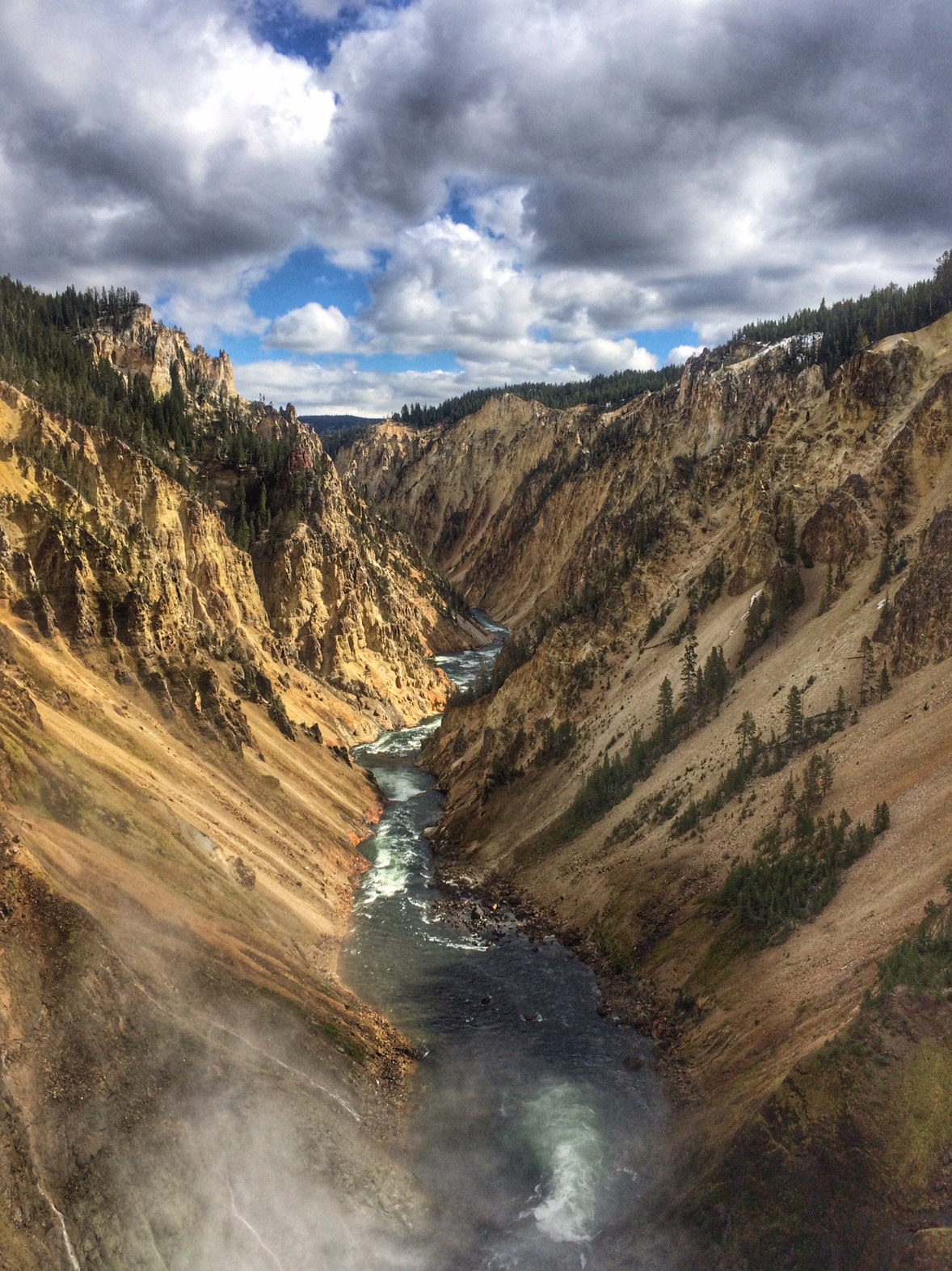
The drive from Yellowstone was filled with beauty at every turn, but I sure was anxious to see the spread of the Grand Tetons in the distance. One of those "Oh my" moments when your mind catches up to all the visions it has seen from this area.
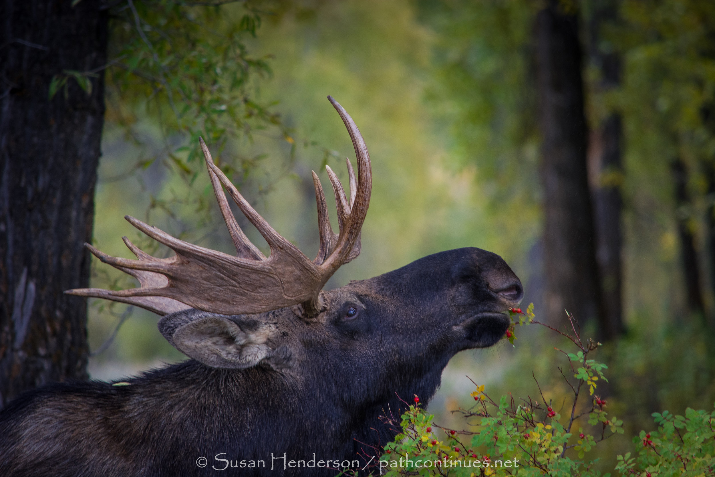
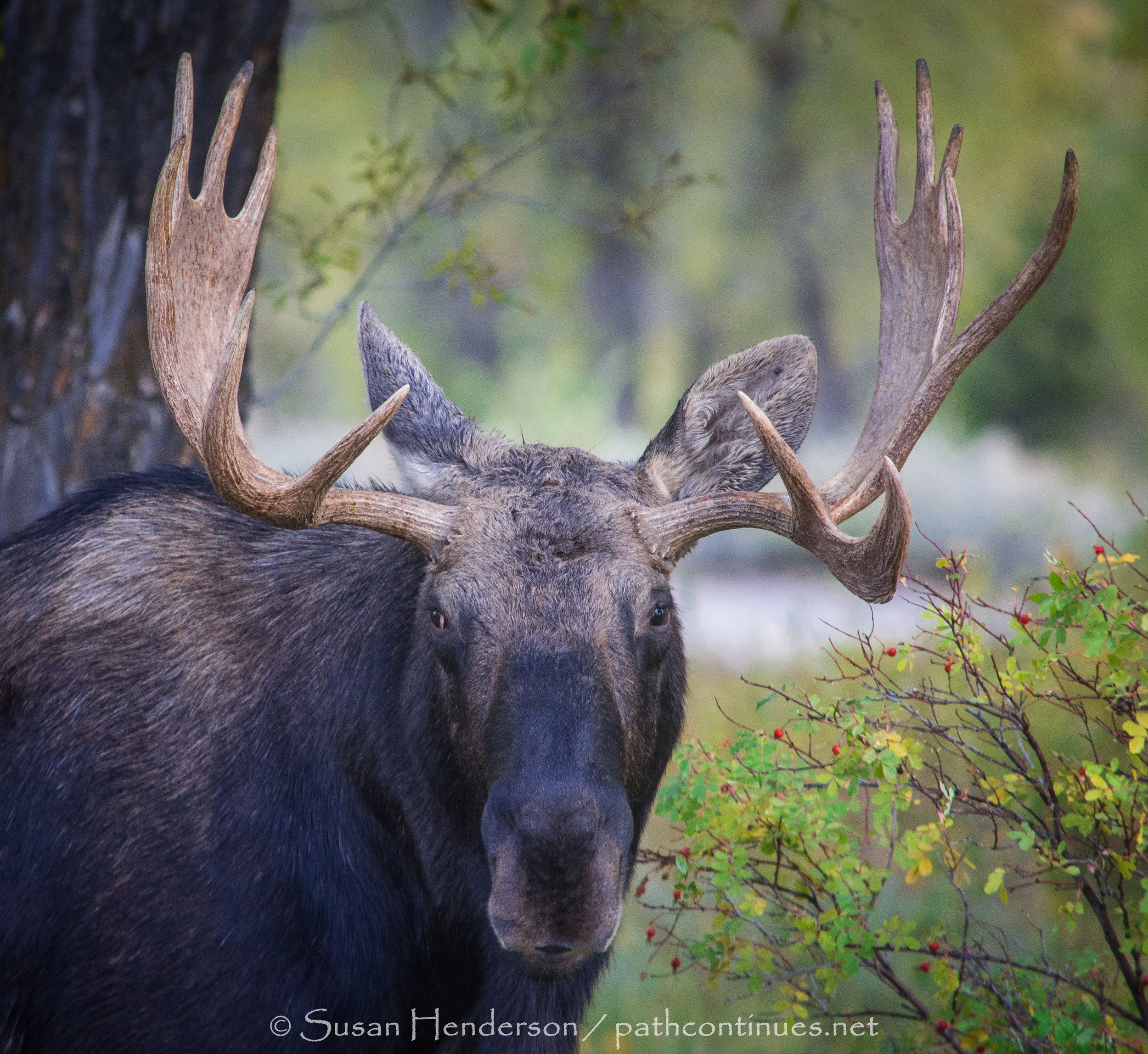
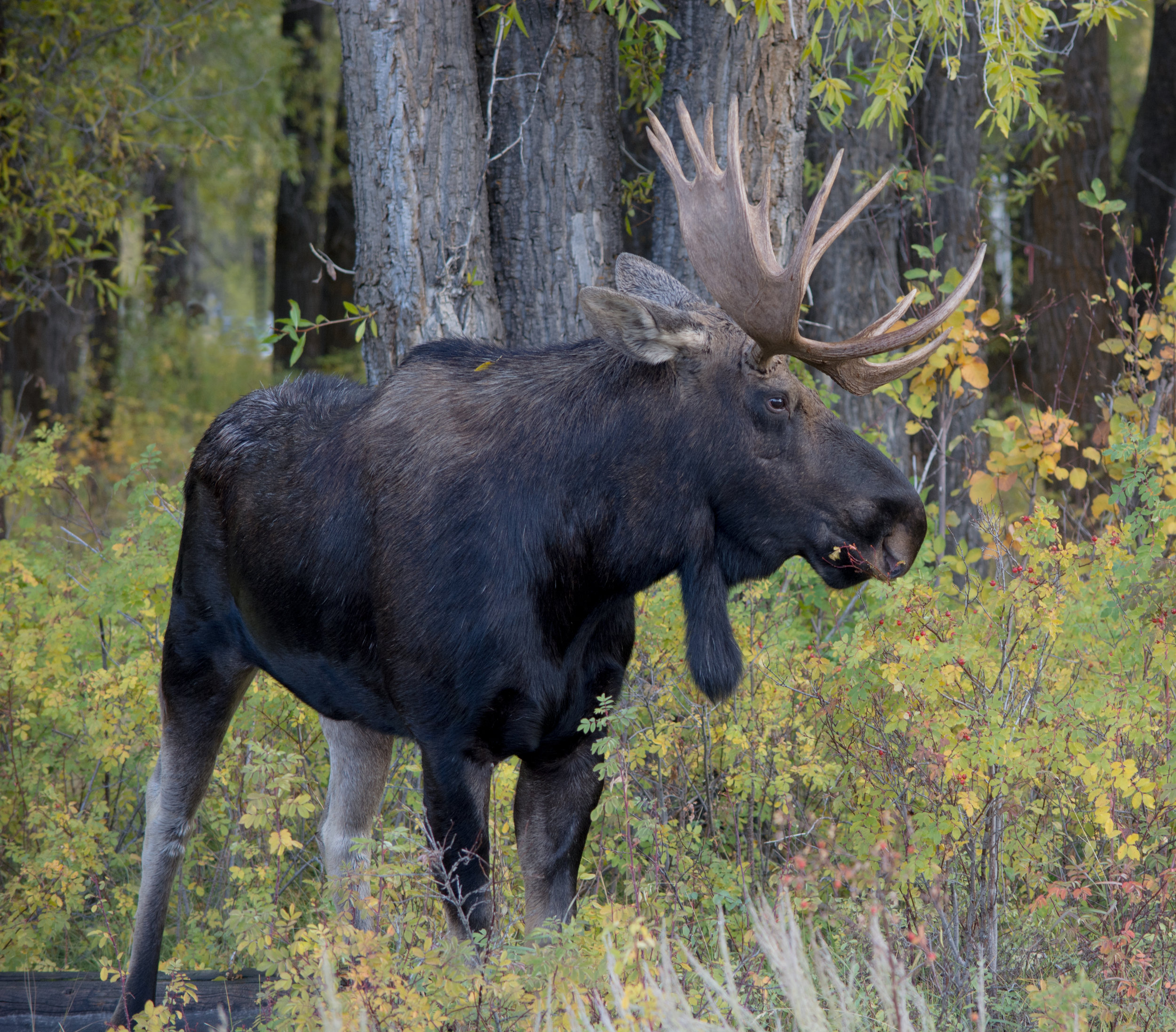
We are settled into a beautiful spot in the park, right on the Gros Ventre (grow-vont) river. The area is filled with aspens and cottonwoods just turning their beautiful golden fall colors and wildlife is abundant, if not a little too close for comfort when a massive moose wanders not 10' from the mhome each day. Now we look for this guy every day at early morning and sunset. So far we have seen him every other day or so.
We have spent our days wandering to all the areas of the park that we could get to in the jeep. The 4-wheel drive has allowed us to meander up some roads that didn't look like they had seen any traffic in quite a while.
Notes: Gros Ventre Campground - Inside Grand Teton Park $14.25 per day with Senior Access Pass (half price). No hook-ups, but there is water and a dump station at the entrance. They do have FULL Hookup available, but 58.00 a day is to spendy for our frugal ways. Handles all size rigs, tents too. We had no trouble getting in Late September-Early Oct, but I would imagine it is impossible in the summer without reservations. We choose this campground as it is in the southernmost part of the park, easily accessible to Jackson Hole. 14 day limit. Closes October 14, 2018 for the season.
We did find Forest Service land not far from the park, but this would definitely not accommodate our size rig (40'). If you are in a smaller rig, or tent, it has a beautiful direct view of the Tetons, and IT IS FREE - 14 day limit.
Thanks for spending a few minutes with me today, and remember, photo cards/prints are available of any image you may like :}


July 26 - 31
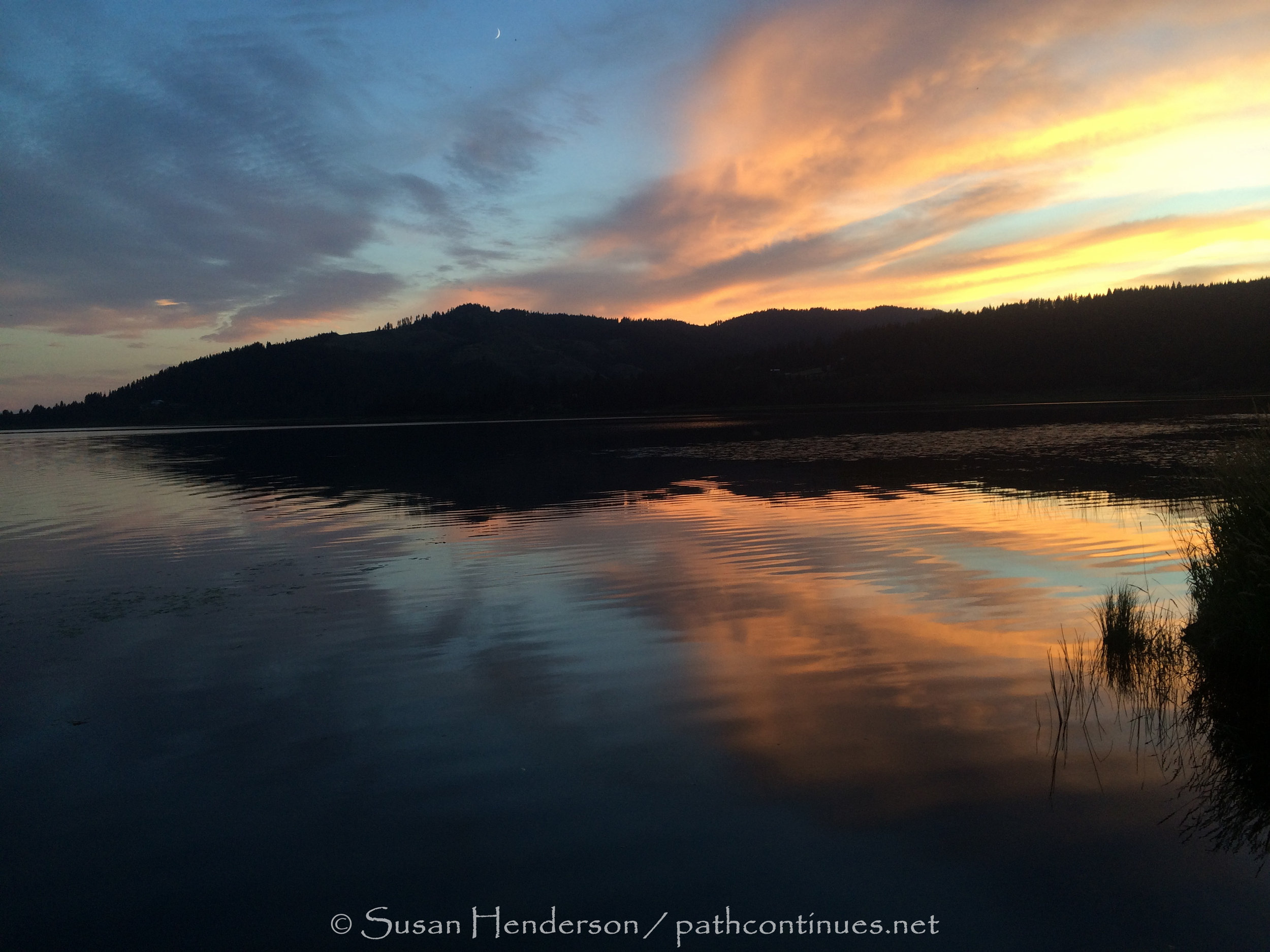
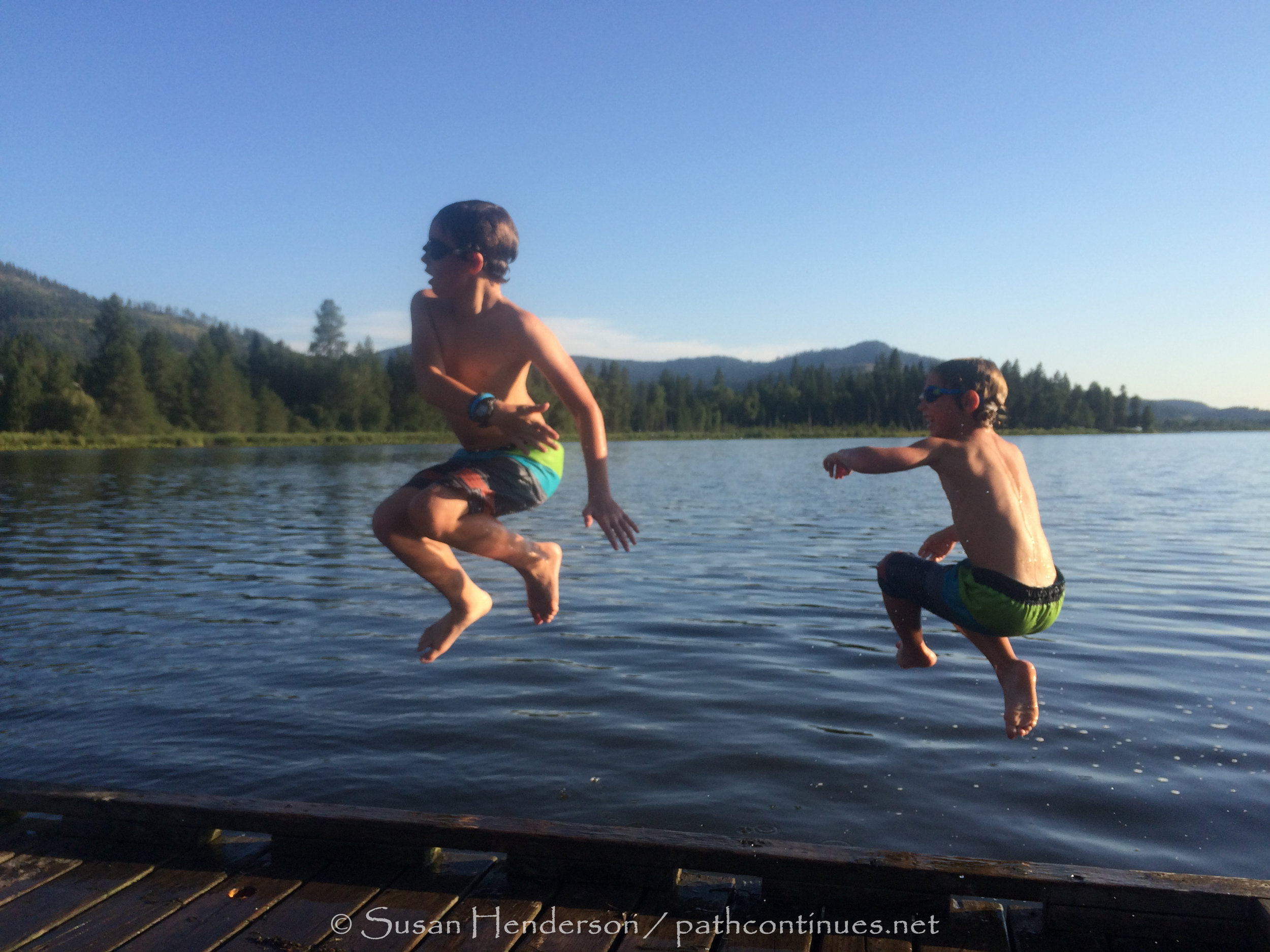
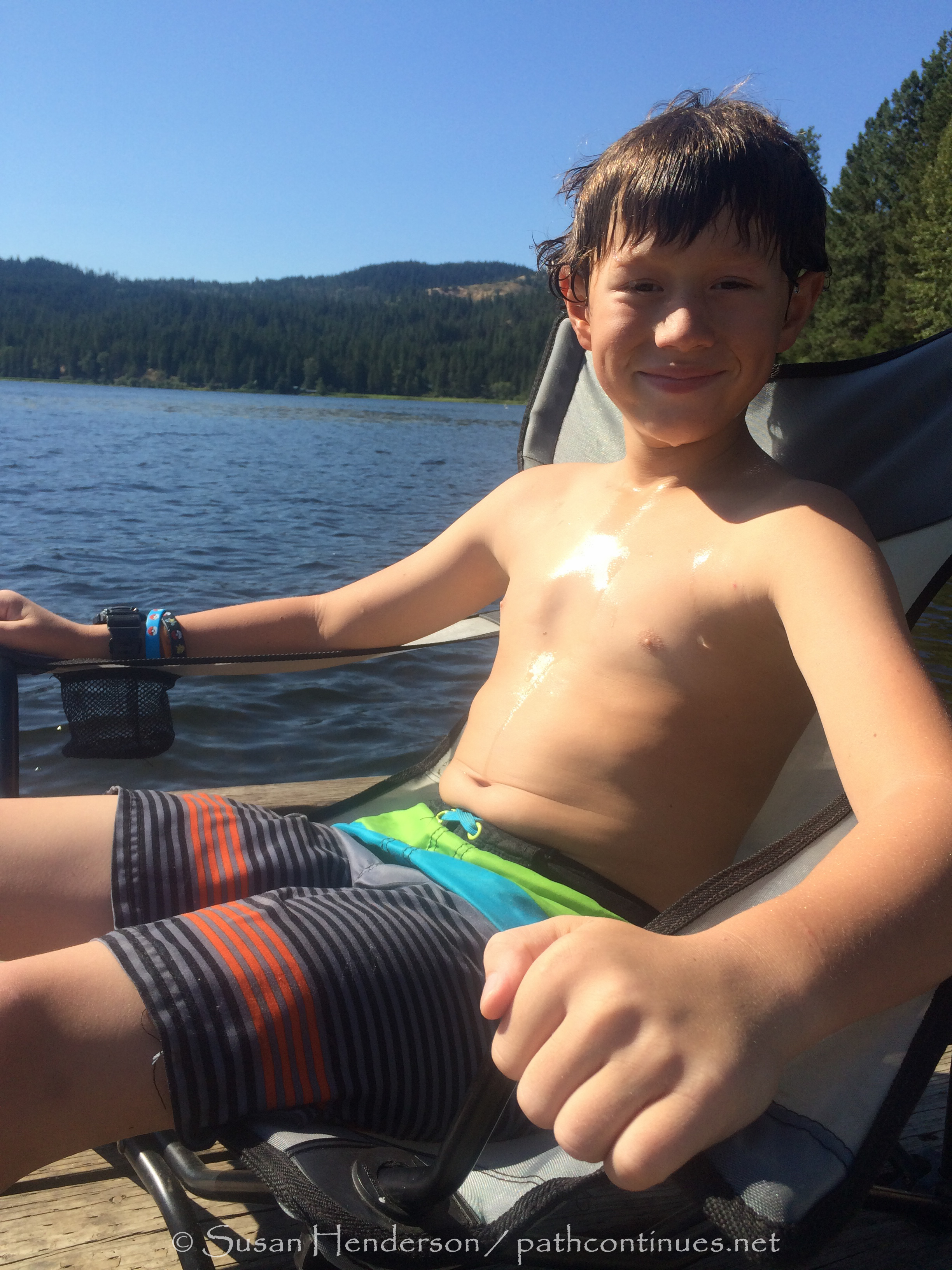
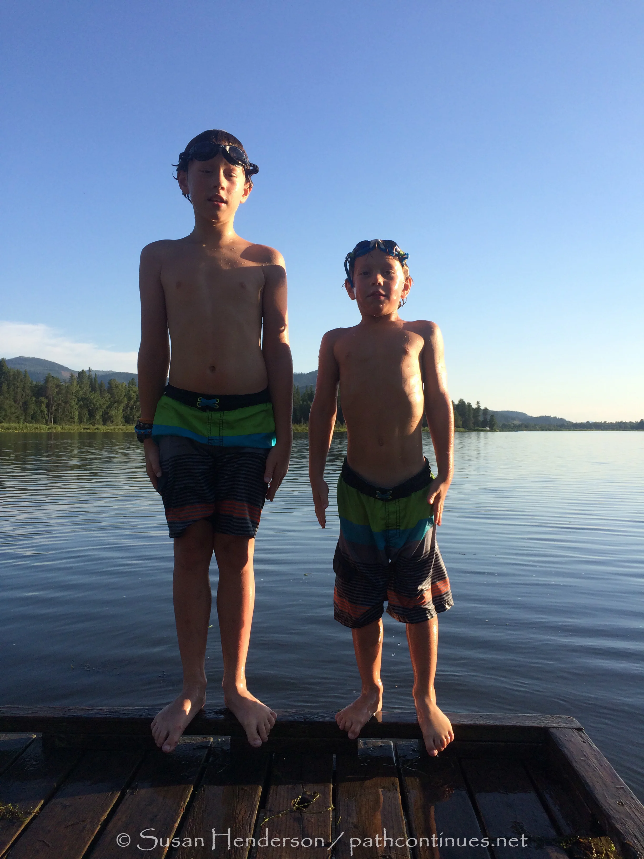
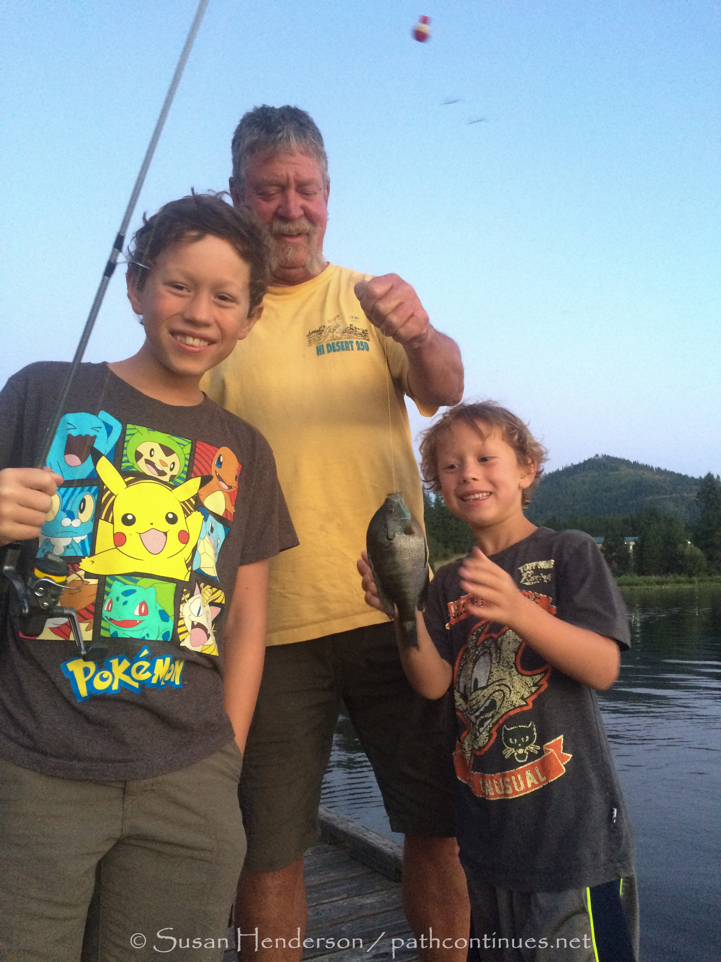
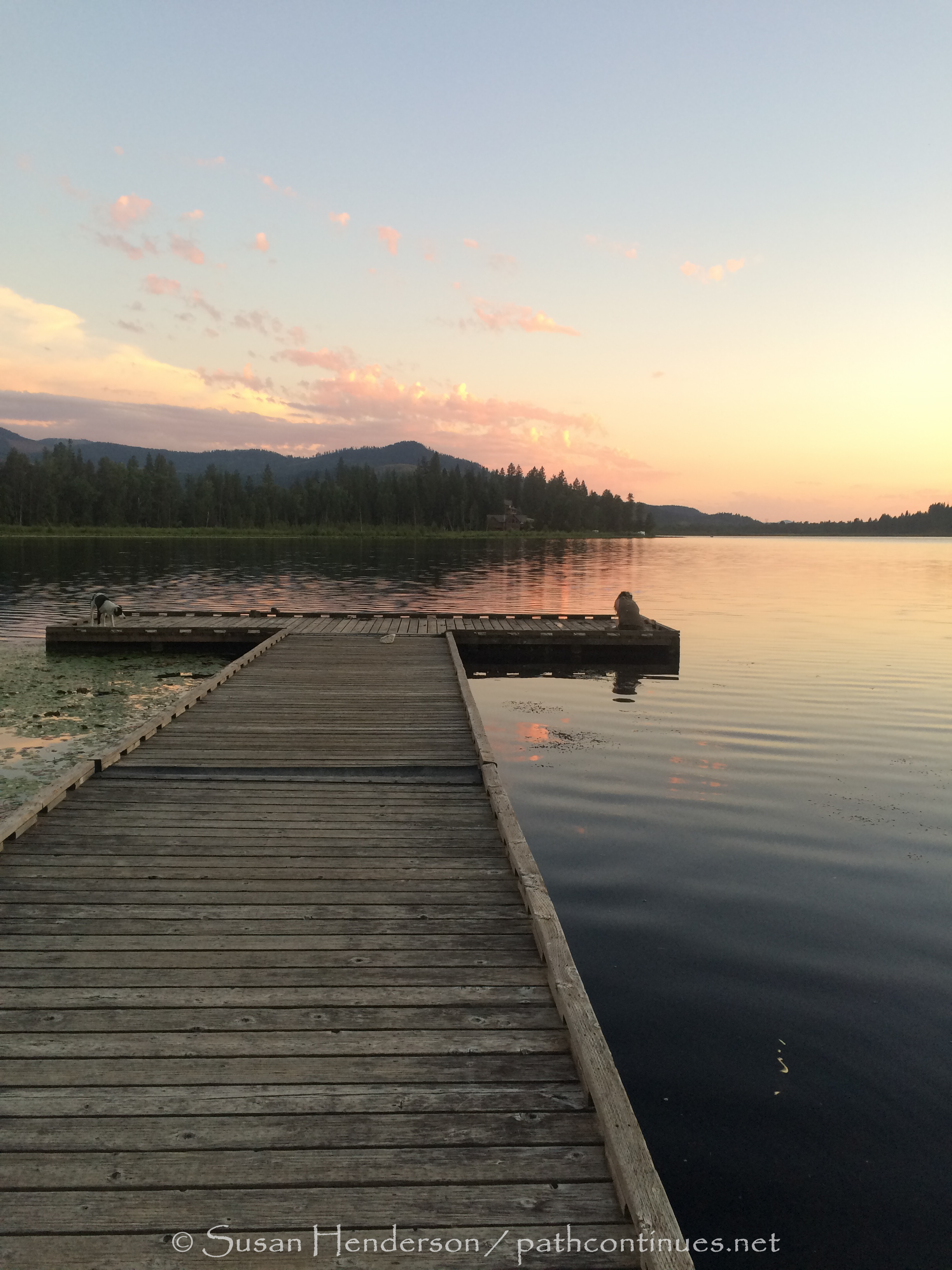
In Northern Idaho for the last week of our trip with the boys. Bob has been following a great site on the web, freecampsites.net, and found us this little piece of paradise right on Rose Lake. There is only one site by the water, and fortunately we got here early enough in the day that it was wide open for us. There are a few other sites across the lake by the boat ramp, but they do not have the shade this one does, nor are they right on the water. After the last two weeks at Jellystone Park in Missoula, the quiet here is exactly what we needed. The boys ride their bikes up and down the dock, and so far, as of the time of day I am writing this, they haven’t ridden off the edge YET! They have waded out into the water, and cannonballed off the end of the long dock. Carson has tried his best to catch a fish with his hands. I don’t have the heart to tell him it probably won’t happen.
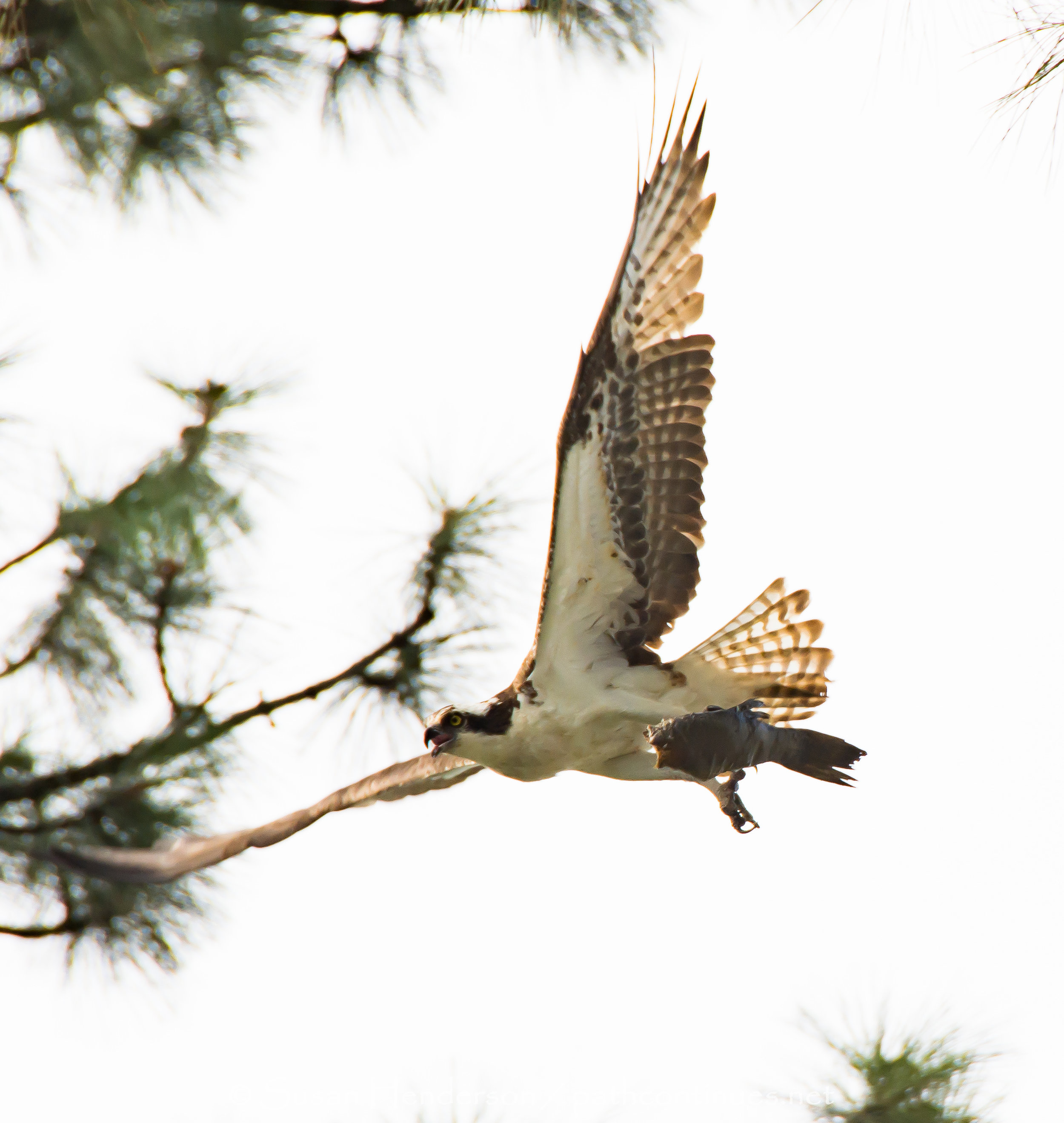
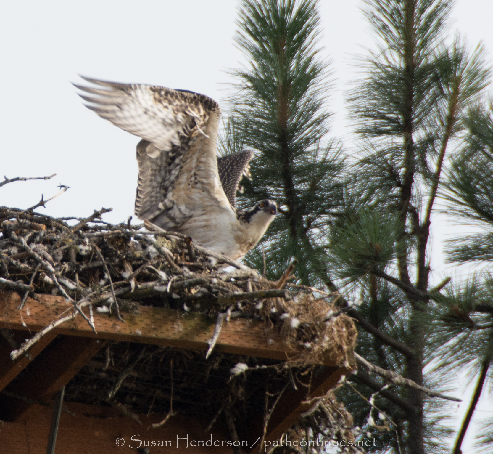
There is a huge sea hawk (osprey) nest right next to us and we watched as the mama flew over with a large fish for the babies’ dinner. Spreading and beating his/her wings, the baby is preparing for its first flight. Perhaps we will get to see it before we leave.
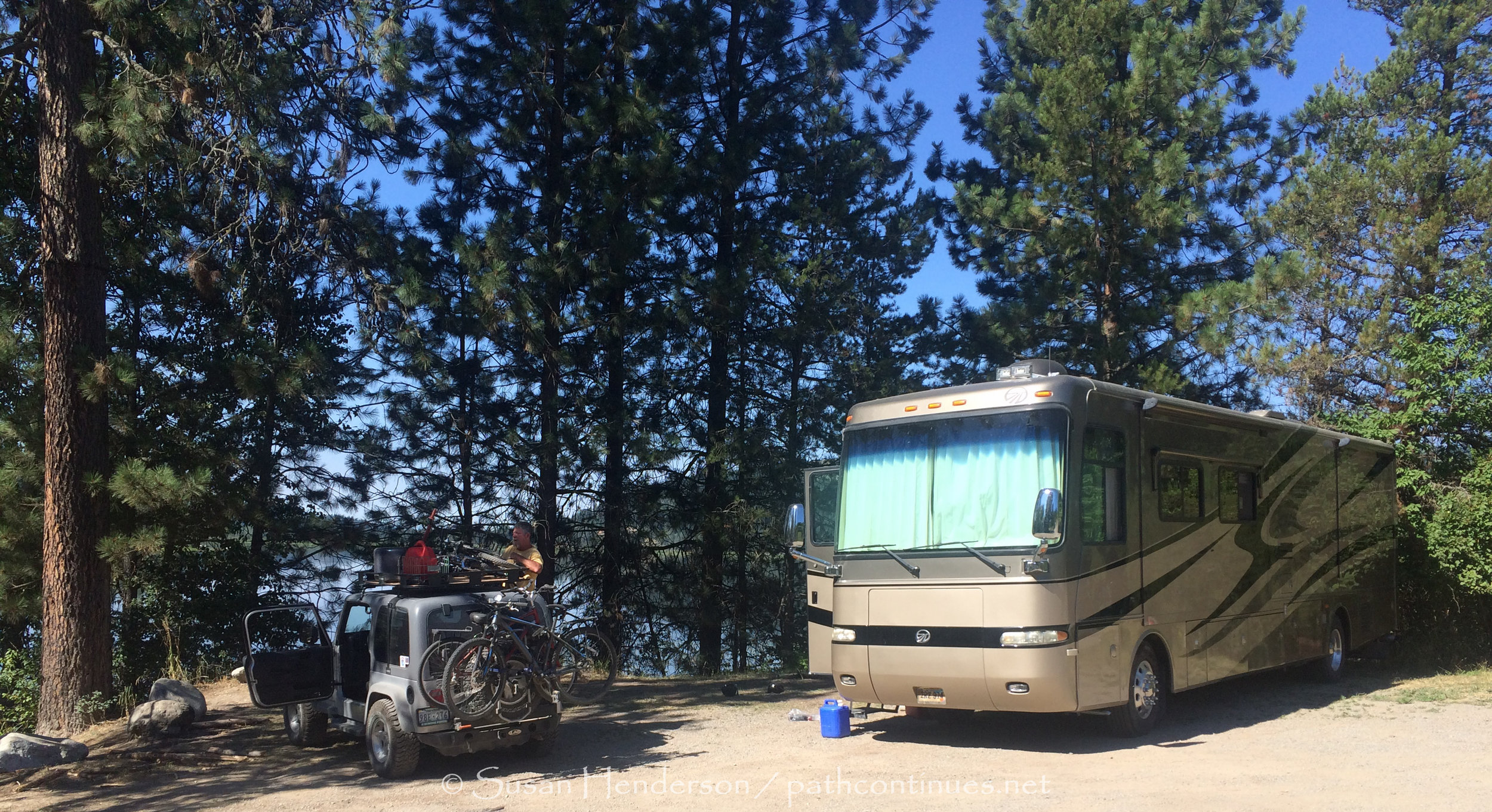
Bob has taken the jeep to Spokane, about an hour west of us. The generator is not working for some reason, and he is hoping to get the part to fix it. He thinks it may have been caused by a big power bump I had while he was gone on his motorcycle trip. I had to reset all the breakers, and plug in a box that controlled the power but it may have done damage anyway. Hoping for the best. He is so good at being able to fix most anything that has gone wrong, we are lucky for sure.
It is so peaceful and quiet here at this site. It is the perfect stop for our last one before putting the boys on the plane back to Sara and Travis. It is going to be so still when they are gone. Trying to ward off the sadness that will surely fill my thoughts the first days after they fly home. Six weeks have gone by in a blink.
Free campsite, approx. 20 miles east of Coeur d’lane, 3 miles south of I-90. BEAUTIFUL SITE, nestled in the pine trees overlooking Rose Lake. Site may not be available for much longer, talked with the State worker and he told us they are having way to much problems with vandalism and drugs. Such a shame, would love for others to experience this quiet and beauty.